The second part of our journey takes us to the islands of Gran Canaria and Tenerife, as well as a side trip by ferry and hire car to La Gomera.
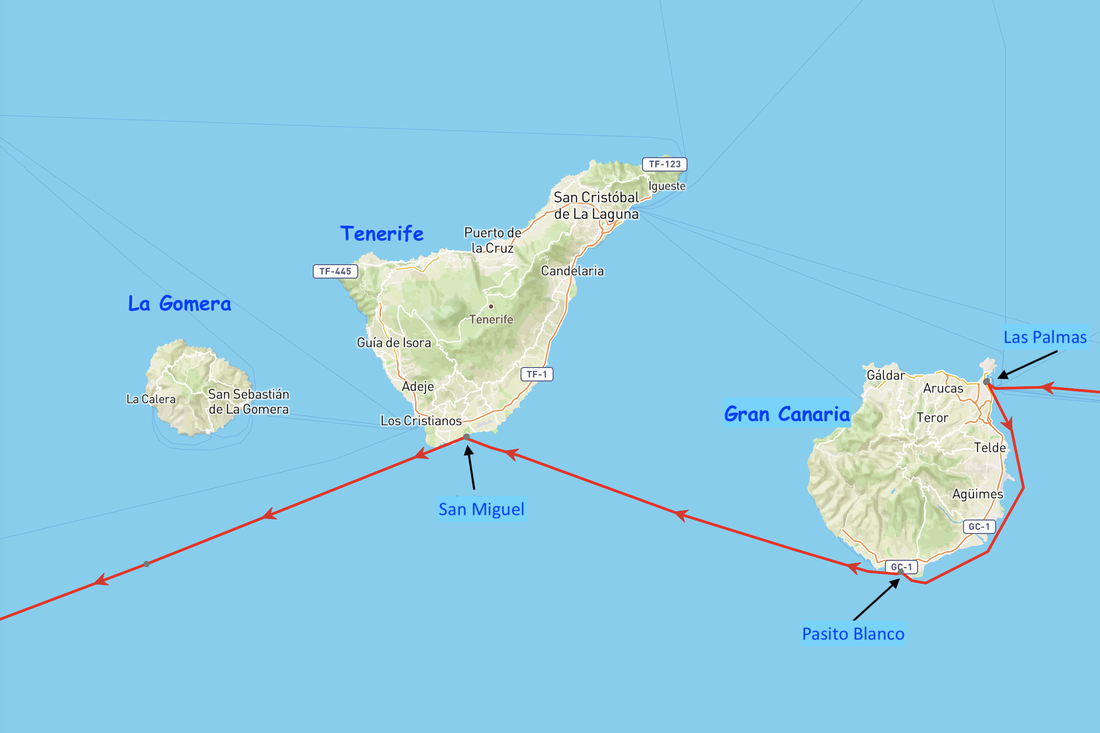
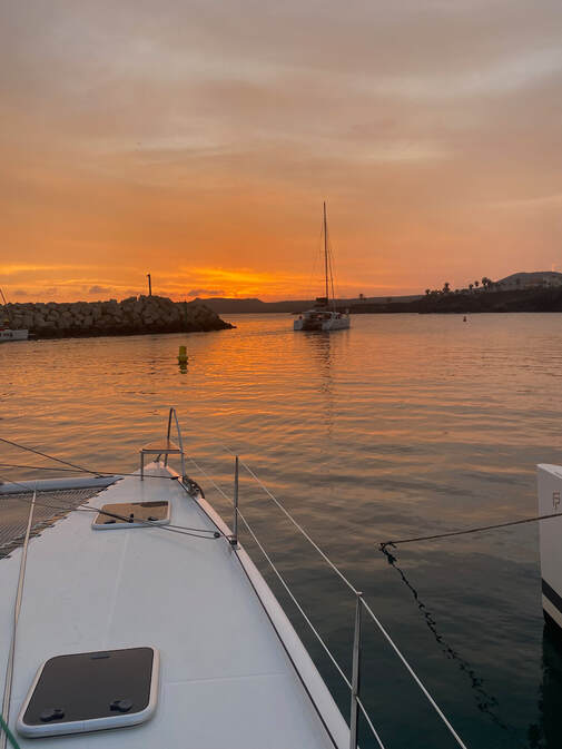
From our anchorage at the southern end of Fuertaventura we had to motor all 47nm across to the the capital of the island of Gran Canaria, Las Palmas, as the breeze was too light to sail. The anchorage is a strange one inside the port, between two busy marinas (full of ARC boats). We are overlooking a container terminal and facing a beach. It’s an odd spot, noisy but very sheltered and calm which makes a nice change. It will be a good base for exploring and the ongoing task of provisioning. The marina manages the anchorage so we have to go in, check in and pay a small fee but we are able to use some of the facilities including the dinghy dock.
Las Palmas anchorage
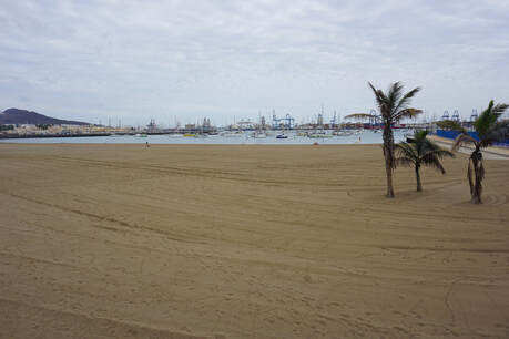
 Church in the old town Church in the old town
We spend a couple of days exploring the town of Las Palmas and topping up provisions. We head downtown to the shopping area and have morning tea, then have a hair raising, high speed bus ride Centro Historico (or old town) and end up having lunch there. I visited the Cathedral whilst Keith visited the Columbus museum. Had a lovely 3 course Menu Dia at a small café before a massive supermarket shop to keep filling our pantry and fridges for our crossing and beyond.
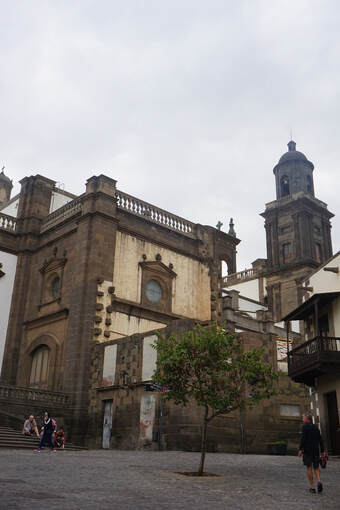
The following morning we left early to head 33nm south to Plasito Blanco, on the south coast of the island. We had light conditions at first but the breeze picked up later as we and we could sail under main and gennaker, mostly goose-winged and up to 20kts TWS (that acceleration zone again). As we approached the SE corner of the island we could see the famous sand dunes of Maspalomas. These are quite extensive, over 400 hectares, and quite important ecologically. There is one large peak on the northern end and there are walking trails throughout the dunes. We pass reasonably close to these to take a look before turning the corner and finding a spot for the night. We anchored between the marina entrance and a 1980s beach resort, (reminiscent of Maroubra) and overlooked by a golf course, an oasis of green amongst the lunar volcanic landscape.
The next day Keith and I went for a walk to find some lunch. Made the mistake of walking up to the top of the cliffs and trying to skirt along the edge of the golf course to get to the 80s resort at the beach, but it was all fenced off so we had to double back and walk along the rocks. Saw Martin and Soni in the RIB, they were looking for Martin’s flip flop which fell off the boat. We had tapas at the ‘80s beach resort and wandered along to Maspalomas (near the sand dunes) where there are more restaurants and resorts and had afternoon tea. On the way back we were walking along the beach and amazingly found Martin’s lost flip flop half buried in the sand. Who would have thought! Fortunately he had not thrown the other one out yet!
Sand dunes at Maslpalomas
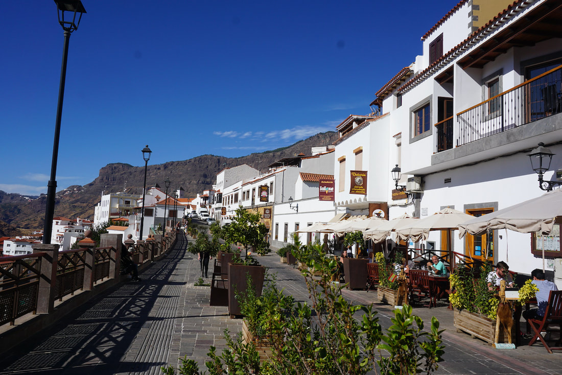
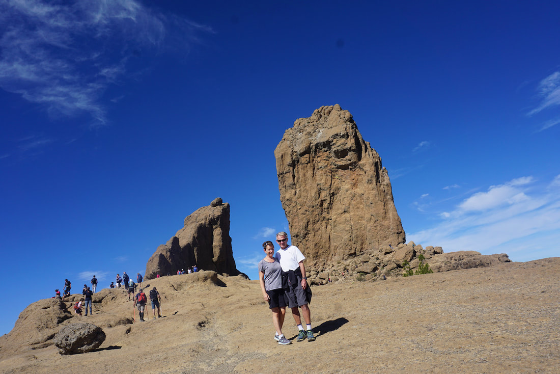
We managed to organise a car, which is no mean feat with so many boats and people around. Picked up the car at Playa Ingleses and headed into the hills. The scenery is quite spectacular, roads are windy and there are heaps of mad people riding bicycles up hill and down on the narrow winding roads. There is a big event coming up so I guess they are practicing. We had morning tea at Fataga on a terrace overlooking the volcanic hills. It’s still very dry in this area, although there are a few more trees than other islands. We head further north along the winding roads, stopping at a few viewing points for photos of the breathtaking scenery. Next stop is Roque Nublo, the second highest peaks on the island, which is a 20min walk up to a plateau to see these amazing vertical rock formations. The view is fantastic and we can see all the way across to Tenerife and its highest peak, La Tiede. The winding roads continue and we stop for lunch at Tejeda. Again fantastic views of peaks and rocks, looking back to Roque Nublo where we have just been. From here we start heading towards the coast, with a quick detour via Pico las Nieves which is the highest point on the island. There is an observatory here, or maybe a military installation and again spectacular views. We continue to wind our way downhill and can see Las Palmas and the airport in the distance. We finally get to the freeway and decide to head straight back to the boat.
The following day is an easier one on the road as we just head along the coast. There are some really heavily developed areas with some very ordinary looking resorts. We finally get to Mogan after a detour/double back thanks to a road closure, and stop for coffee and cake. This area is well and truly over developed for mass tourism, with resorts lining the hills around even the tiniest of bays. Most of them are not particularly upmarket or attractive. After a supermarket stop we head to Maspalomas for lunch, intending to have a walk through the dunes but the wind direction has changed and strengthened so Keith and I head back to the boat while Soni and Martin take the car back. It’s a very bouncy RIB ride back for all of us!
We spent the time here ticking of our list of jobs to prepare for the crossing, a lot had already been done but there always seems to be more to do. The provisioning frenzy continued as well. That said we still had time for a little bit of sightseeing. There is not much happening around the marina area, which is part of a big resort complex with golf course and numerous apartment complexes, but you can walk along the coastal boardwalk to the nearby town of . We did manage to find a café run by a British lady that served an excellent Sunday Roast (oh how we miss lamb) with Yorkies! 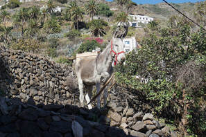 A Local Resident A Local Resident
Tour of La Gomera.
This small circular island is a mere 17nm from Tenerife at its closest point. It is only 22km in diameter and its highest peak (Alto de Garajonay) is a mere 1,487m. It is the greenest of the islands we have visited so far, with thick forests which are often shrouded in mist. We took a taxi to Los Christianos, and from there ferry to La Gomera, picked up a hire car and headed off along the narrow, windy roads. Had a traditional Canarian lunch via Google translate. It was fairly heavy, starchy and frankly a little weird. The visitor’s centre in the National Park was well worth a stop to and we learned about the Gomeran whistling language (Silbo) which was used to communicate in the hills between villages. It helped to find missing goats or communicate local news. We could also see how villagers used a long pole to travel on foot through rough and rocky terrain. From the north coast we could see views of La Palma, the island with recent volcanic eruptions and evacuations. This is as close as we will get. Then its back to San Sebastion for a look around the town before catching the ferry and taxi back to ITIKI. 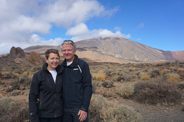
La Tiede
Tour of Tenerife
Picked up a hire car from the airport and did a tour of Tenerife. First stop Mount La Teide. At 3,715m above sea level it is the highest point in Spain and the highest of the Atlantic islands. We drove up towards the peak, had lovely morning tea and cake at a small village along the way. The road then takes us down into and through the main crater with numerous photo stops along the way. It’s an incredible and quite diverse landscape, not completely devoid of vegetation but pretty dry. There are areas of lava flows, lunar landscape and vertical rocks, once molten outflows but now left behind after erosion of the surrounding soil. It was very chilly up top with clouds often descending to cover the peaks and descending down into the crater. It wasn’t possible to go to the peak of La Tiede as the cable car was not operating due to high winds, which is a regular occurrence. Then down to Santa Cruz, the capital of Tenerife, for lunch and a wander round.
And so our time in the Canary islands has come to an end. Whilst the main reason for coming here was to use it as a staging point for our Atlantic crossing, it has been well worth a visit and we could have easily spent more time here. Given the time of year it was sometimes cool at night, and the water was also a little cool for swimming, but certainly clear, clean and refreshing. It was a good place to provision, although the fruit and veg was not always the freshest and a lot of it is obviously imported. It was busy with patrons of the ARC which at times was frustrating. Apparently, it does get less busy closer to Christmas as the ARC boats depart, emptying the marinas and returning their hire cars, however there is now a January rally so perhaps that doesn’t last too long. Don’t forget you can read about our Atlantic Crossing – first attempt and second attempt – in my previous blog posts.

2 Comments
Alan & Ann
10/2/2022 08:17:01 pm
Wow. What a logistical & environmental challenge. These experiences are invaluable but not sure we could do this. I get stressed asking directions to the nearest Sofitel 😂
Sarah Dunne
11/2/2022 02:34:44 pm
I never realised how volcanic and barren looking in places the Canaries are - very useful geography lesson with as always your great descriptions and photos. Have actually been to the Caneries as the liner I was on with Michael and Matthew as two little boys. Can't remember much except we nearly missed getting back on board because the Captain changed the departure time without telling the passengers(it was an Italian Ship!!) Leave a Reply. |
AuthorAfter more than 5 years of (minus time off for Covid) and more than 27,000nm Lynda has finally got the hang of this cruising life Archives
June 2024
Categories |
 RSS Feed