1. Tahanea Atoll
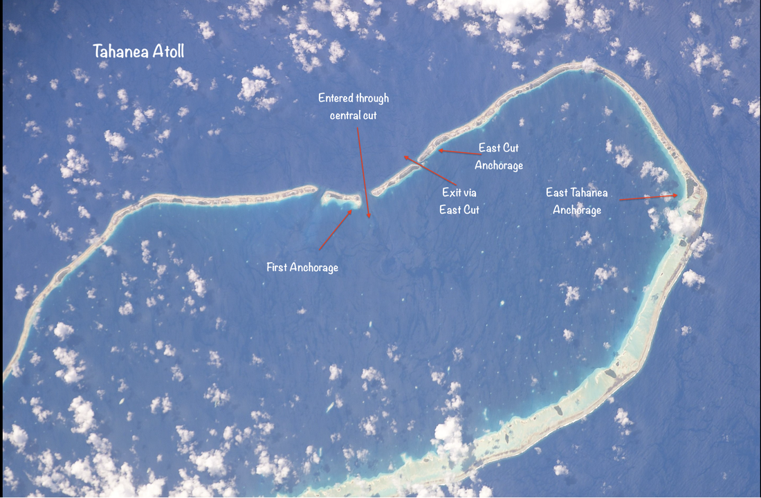
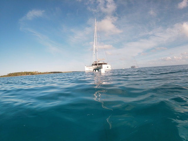
After our very slow, frustrating, drift/sail we arrived early in the morning and could see land 12nm out. We were a little early for the tides so we motored around for a bit doing some fishing, while we waited for the right moment to enter through the cut (as usual, nothing caught). With the sun out and good, clear visibility we went in through the cut, staying slightly to the left of the visible current. The turbulence in the water briefly blocked the transducers, and the depth read went blank momentarily! A little scary but thankfully short lived. We turned right as we came in through the passage and there was no one in the anchorage so we had our pick of spots. We were able to find a good patch of sand and deployed our chain floats fairly expertly. Ollie on Mai Tai was leading the way, anchored close by and jumping straight in the water to check out both of our anchors. Time to catch up on sleep.
Tahanea is an uninhabited atoll, a nature reserve. Although there are a few seasonal workers living here, fishing and harvesting coconuts for copra, there is no village, no phone signal, no shops. Just us and nature, plenty of sea life and birdlife. Sadly the native trees are being removed to plant coconuts for commercial purposes. Humans can’t seem to leave anything alone if there is money to be made.
Snorkelling the cut
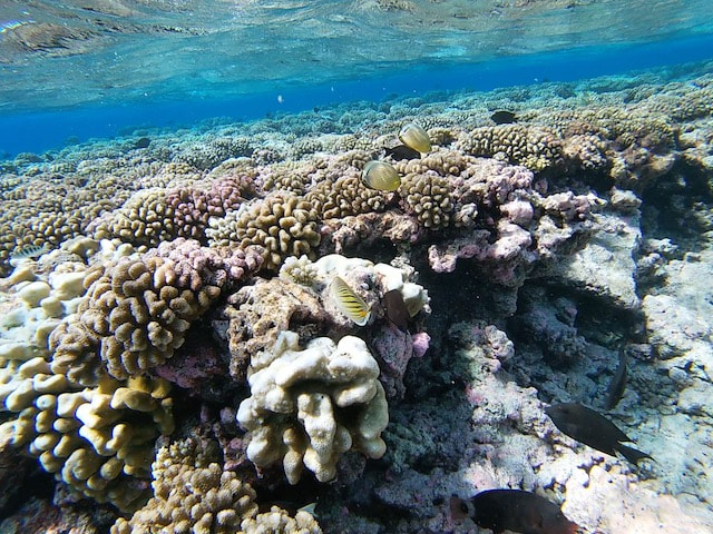
We entered this atoll via the Teavatapu Pass, and this was the first pass or “cut” where we did a “drift snorkel” - a trademark experience of the Tuamotus. The cuts or passes are natural openings in the atolls where tidal currents flow in and out of the enclosed lagoons. Yachts can enter and exit the atolls of course, and the incoming water is rich in nutrients, so sea-life abounds in these passages. Here we can see colourful and healthy coral gardens and a variety of fish of all sizes, progressing up the food chain.
You have to time your swim so that speed of the flow of water is just right. Not so fast that your view is in fast forward, not too slow so that you have work hard to kick and swim. Just after slack tide, we took the dinghy to the outside edge of the pass to catch the incoming current. It seemed a bit rough at first so I stayed in the dinghy and watched the boys for a bit, but eventually jumped in and just held onto the painter. The timing was just right, very little effort required as the tide gently takes you along towards the inside of the atoll. It’s like a scenic railway with the underwater scenery passing below you as you drift slowly by. It’s interesting to see how deep the channel is after coming through it. Its shallow close to the shore where most of the fish and coral are, then it drops off steeply into the abyss in the middle. Next comes the challenge of getting back into the dinghy from the water. The trick here is to leave your fins on and kick like mad to propel yourself vertically upwards so you can get enough of your upper body over the edge of the pontoon. Then follows a rather undignified scramble to swing a leg over the pontoon so you can flop into the dinghy. That takes a little practice!
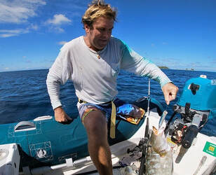 What a catch! (I mean the fish...) What a catch! (I mean the fish...)
Ollie brought a fishing rod with him so we did a little dinghy fishing. Within minutes of casting a line he had caught a Sweet Lips but after deftly removing the hook, threw it back. He was concerned it looked too big and old and probably had Ciguatera. Ciguatera is a toxin that is produced by a marine algae that is eaten by reef fish, who are in turn eaten by bigger fish. The toxin accumulates in the food chain and the bigger and older a reef fish is, the more likely it is to have a good dose of the toxin. Ingesting the toxin leads to diarrhea, vomiting, numbness, itchiness, sensitivity to hot and cold, dizziness, and weakness. Symptoms can be quite severe and poisoning can even be fatal! Best to play it safe and stick to pelagic fish! Or like us, and never catch any fish…
Copra Shed Anchorage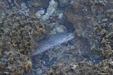 An eel trying to hide in the lagoon An eel trying to hide in the lagoon
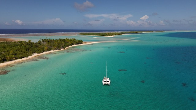
When we arrived we were the only 2 boats, but now there are 14 boats! We decided to move down to the Copra Shed anchorage in the east, for a change of scenery. We upped anchor without major incident and had a really easy run down, good visibility and bommies were well marked on the charts, apart from one close to the start of the shelf. The sand patches are huge and bommies well-spaced so we could find a spot where we didn’t need to float our chain. It’s a stunning anchorage with an false cut and a sand spit nearby. There are some copra farmers ashore and one other boat here. After lunch we put the drone up to get a birds eye view, and then go for a SUP. Although it looks like a sandy beach ashore, it is actually coral gravel. Its really tough to walk on, even in reef sandals. We walk around the sandspit, and into the small lagoon between the fringing reef and the inside of the atoll. In the trees there are some boobies nesting and we spot one gorgeously fluffy baby bird that looks like a ball of fairy floss with a beak! I snorkel on some small coral bommies closer to shore and a couple of small black tips are swimming around the back of the boat. A group of 5 remoras has also taken up residence, waiting for scraps.
Overnight the wind switched north and the anchorage got pretty bouncy. With a westerly expected it was only going to get worse so we decided to move back to the East Cut anchorage. A few other boats have moved across here as well. We were expecting the trip back to be bumpy but it was ok, and again bommies were easy to spot.
We went for a drift snorkel through the East Cut. Water was flowing pretty fast but the amount of coral was amazing, even though we scooted past it so quickly!
The next day was very calm so we went with Ollie outside the atoll in the dinghy and snorkeled the drop-off on the windward side of reef. It was interesting to see as it really does disappear into the abyss. These atolls really are anomalies, shallow lagoons that emerge from the very deep waters of the pacific. There was more sea-life closer to shore in the shallows. Did another drift through the east cut as well, this time from inside to outside as the tide was going out and saw much more coral and life on the east side.
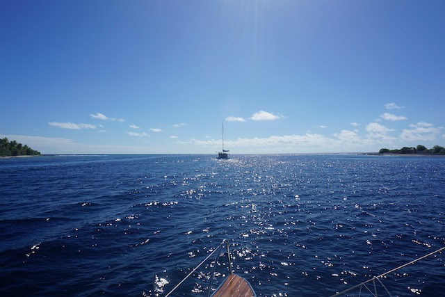
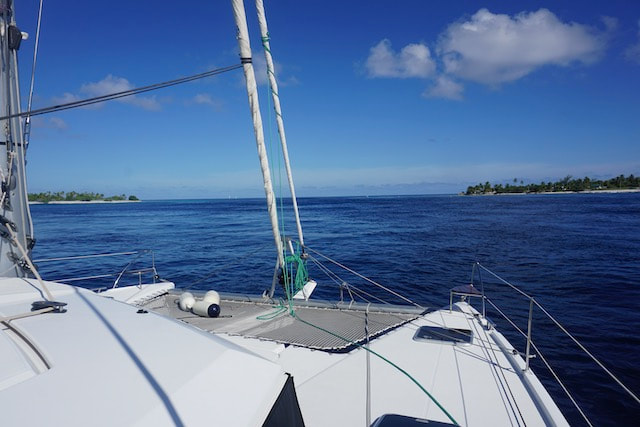
One more motu - off to Fakarava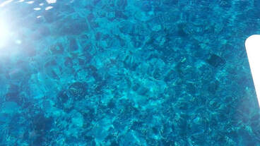 Looking over the bow as we cross the east cut Looking over the bow as we cross the east cut
Well it is time to leave Tahanea and move on to our final atoll in the Tuamotus. Having surveyed it from underwater as we snorkeled it several times, we agreed it was safe to exit via the east cut, even though it is not a marked passage on the charts. We motored out while I kept a lookout on the bow, the water was so clear I could clearly see the coral garden passing below us. We are heading to the northern end of Fakarava where there us town, as we need a few provisions and Ollie is out of beer. Its 90 nm so we will do an overnight passage at "normal" speed.
1 Comment
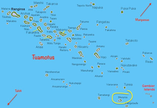
The Tuamotu Archipelago or the Tuamotu Islands are a French Polynesian chain of just under 80 islands and atolls in the southern Pacific Ocean. They lie between the Marquesas islands and the Society Islands and stretch all the way down to meet the Gambiers in the east. In Polynesian language Tuamotu means 'remote islands' and they certainly are isolated! They are the largest chain of atolls in the world, extending (from northwest to southeast) over an area roughly the size of Western Europe, although their combined land area is only 850 square kilometres (328 square miles) - about 1/3 the size of the ACT! This archipelago's major islands are Anaa, Fakarava, Hao and Makemo and we visited two of those as well as Tahanea. Australians and Kiwis will sadly be familiar with Muraroa Atoll which lies in the far eastern part of the chain. This is one of the atolls where the infamous French nuclear testing took place.
The Tuamotus have approximately 16,000 inhabitants and their own Tuamotuan language which was inherited from the Polynesians, the first known inhabitants of the island. Like the Marquesas, the Tuamotus are now a French overseas collectivity.
All of the islands of the Tuamotus are coral "low islands": essentially high sand bars built upon coral reefs. They are circular or oval shaped with the higher land on the north- eastern sides, and bare fringing reefs on the windward or southern sides. Not much grows on the poor soil, coconuts palms are ubiquitous however and the flesh is harvested to make copra which is made into coconut oil. The lagoons are an ideal place to grow oysters and a number of atolls now host pearl farms, which produce the famous black “Tahitian” pearls and of course tourism has made it to some of the atolls, although it’s easy to avoid when you have your own yacht. Underwater the beautiful coral reefs are teeming with colourful and unique fauna, some of the best snorkeling we have experienced outside of the Barrier Reef, and we very much enjoyed exploring these. Making The Cut
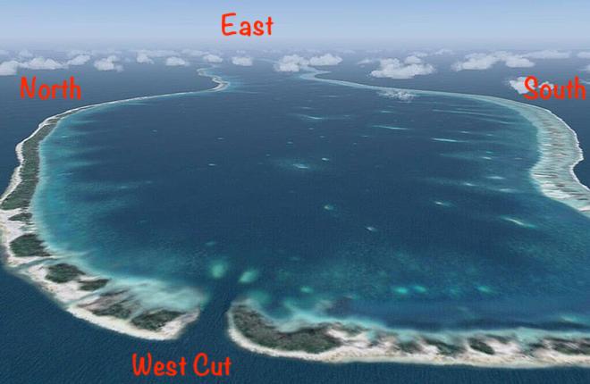
From our anchorage in Taiohae Bay, Nuku Hiva to the atoll of Makemo in the Tuoamotus is 503nm. Each of the atolls generally has one or more entrances or “cuts” which are channels of varying depths and widths that boats can enter into the lagoon, through a gap in the coral reef. The cuts are naturally formed so each cut is unique in terms of location on the atoll, its depth and width and consequently the effect of wind and tide on the way water flows into and out of the atoll. It’s important to ensure you time your entrance through the cut well. Some cuts are known to produce standing waves if there is a strong wind-over-tide effect and you don’t want to be pounding into that coming through a narrow gap! If you have ever been to the Horizontal Falls in the Kimberlies you will have experienced how quickly a large volume of water can flow through a narrow gap, creating rapids. Well its kind of like that in the cuts, although thankfully most are not so dramatic.
It’s not always as simple as approaching these cuts right on slack tide, as some atolls have a huge volume of water wanting to move out, so even at the turn of the tide, and sometime thereafter, water may still be flowing in or out quite quickly. Around the mouth of the cuts, on the inside and outside, water swirls and back eddies and can make it difficult to steer and to line yourself up with a narrow cut. You need to have both engines on and be prepared to use them in anger!
There is a lot of talk amongst cruisers about the best time to enter and exit each of the atolls. One clever cruiser with a lot of time on their hands has developed a very sophisticated “guess-timator” – as an excel spreadsheet it’s a work of art! We try to get our heads around it and figure out what is the best time to go through the main cut at Makemo, but give up in the end and take it with a grain of salt. Now we just have to time our arrival to be in daylight, as well as being no more than 1-2 hours after the tide turns… Yeah right! Making it to Makemo
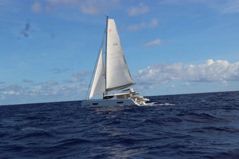
We set off on Friday morning, about an hour or so after our boat buddy, Ollie on Mai Tai. He is sailing this passage solo so we aim to keep in touch with him on a regular basis along the way. We are two sail reaching with pretty good conditions but still we don’t catch him up until the following day. Great to get some photos of each other under sail. He continued to message us his position every 3 hours so we could keep track of him and await his arrival.
At 2am on Monday morning we put the motors on to ensure arrival in daylight and with a reasonable timing for the cut. Hooked a big bull Mahe Mahe but he jumped a lot and sadly we lost the fish, hook and lure. Dang! It would have been pretty good to see the look on Ollies face, as he didn’t manage to catch anything. It’s flat calm as we arrive so the entrance to the Makemo cut looks fairly benign. We can see some eddies and swirling foam on the water but wonder what all the fuss was about. As we come in we can also see some people “drift snorkelling” on the outgoing current in the cut, towing their dinghies with them. This will become a favourite pass-time in the Tuamotus. We anchor in at the township of Pouhava amongst the rocks and bommies, it’s not the best holding as the ground is pretty hard, but its calm enough for the night.
Are you yanking my chain?!
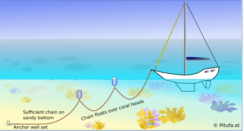
When you are anchoring amongst coral heads (bommies) it is important to avoid damaging the coral with your anchor chain, which can happen when the boat swings around and the chain rubs against them. The other potential problem of course is that your anchor chain can get wrapped around a rock or coral head, as the boat turns at anchor and this shortens your scope, or end up breaking something. It can be difficult to untangle this and lift the anchor when it comes time to leave, and it is not unusual for cruisers to need a diver to get them out of trouble.
So in the Tuamotus we have to do what is called “floating your chain” when I first heard about it I thought: you must be yanking my chain! What a palava! But it is totally necessary in these parts. It involves:
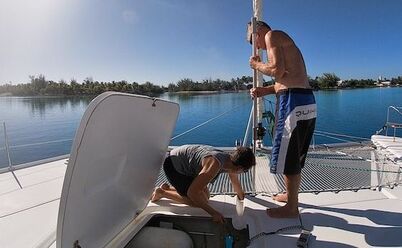 Skipper on foredeck with boat-hook, it must be serious! Skipper on foredeck with boat-hook, it must be serious!
With the anchor on ITIKI set back behind the trampoline, the chain is not readily accessible to reach down and clip these floats on to the chain. We consulted other Helia owners and came up with a system of using a guide wire (VB cord) to take the lanyards on the floats back under the trampoline and into the anchor well so I could clip them on just like I do with the bridle. Needless to say our first attempt at implementing this was somewhat comical. The float lines got caught on the wrong side of the bridle rope and a fair bit of poking and prodding under the trampoline with the boat hook, along with some creative language, was required to sort it all out, much to the bemusement of the rest of the anchorage. In the end we finally got 3 floats on and it looked sort of ok, although probably a bit excessive for such a shallow anchorage. As there was no pressure on the anchor though, the weight of the chain pulled all of the floats together in a bunch – this could get ugly. Once the wind gets up and we pull back on the full scope of our chain, some of the buoys get pulled under water. They are still doing their job of keeping the chain off the bommies though, and we have made some revisions to the process for the next attempt. There are some pointy nosed fish that come by and start munching on the substantial green growth on our bridle rope. I hope they stick around and do the hull as well.
Cruisers' Committee Evaluates the Weather situation
As soon as we are anchored and settled we are invited for 5pm drinks ashore. There is one boat that we have met before, all the other boats we are meeting for the first time but they are very welcoming. If you believed what you saw on Instagram you would think we have perfect weather all the time, however experienced sailors will know that is not the case. We have all seen the forecast strong winds that due from the SE in couple of days – we later find out it is known as a “Squash” – more on that later. Everyone plans to move to another anchorage, either east or west, where the holding is better. We will go east.
Makemo manoeuvres – time to play spot the bommies
Ollie arrives the following morning having done an amazing job going solo for the first time. We go ashore, for a shop and order fuel. I go for a snorkel in front of the boat while we are waiting for delivery and find some big coral bommies with lots of small but colourful fish. We leave around 2pm, which is getting a little late - everyone else has already gone, and for a while we could hear them on the radio working together to spot bommies.
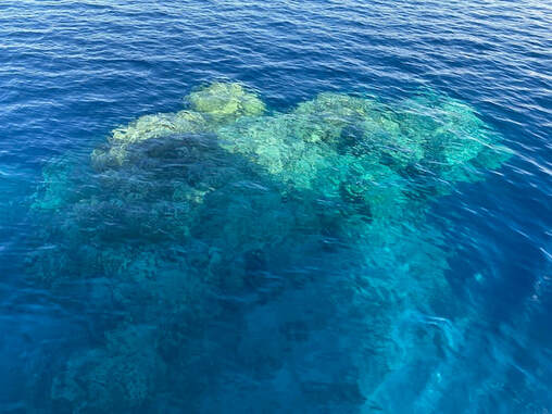
This is our first time navigating inside an atoll. We have been warned that our electronic charts showing the location of bommies and shallows may not be all that accurate and may be missing information. We can use satellite images from Google Earth on our phones, whilst we have internet coverage, but there is no substitute for Mk 1 eyeball on the water. It helps that the water is crystal clear and sun is still overhead. I stand on the coach house and scan in front of us. Polarising lenses are a must and I also use the binoculars to scan further ahead. We have our sonar switched on, but unless you are going quite slowly its warnings are likely to be too late. There are bommies that appear out of nowhere and break the surface. On the electronic charts there are unlabelled circles that seems to correspond to the location of some of the bommies, and it turns out to be pretty accurate. That said, we can’t rely on a blank space being free of danger. We get into a rhythm of scanning, spotting and navigating our way safely to the anchorage at Makemo East.
Anchoring goes much better this time. The water is just so crystal clear it is easy to find a good patch of sand and position ourselves well between the bommies and rocks. We find a larger sandy patch and nail the anchor, the floats go out smoothly and I swim the anchor and check it. With some weather coming we are much better off here, nicely dug in.
Makemo Mayhem
It’s the morning of the day the “squash” is forecast to arrive – what can we expect? how strong will the winds be? What time will it come? How long will it last? Looking at the forecast animation (I wish I recorded it) we see Makemo in a zone of no wind (blue) but coming up from the south-south-east is a sharp edged, dark, angry, red front where the wind goes from nothing to 35+kts. In other words it is going to hit like a bulldozer, pushing some nasties ahead of it.
A squash zone forms when an east-traveling high pressure system is very strong and/or moves very close to the tropics. The isobars on top of it are "squashed" together and the resulting trade winds are pretty strong. These southeasters generally arrive with a nasty cold front after the convergence zone or trough has passed.
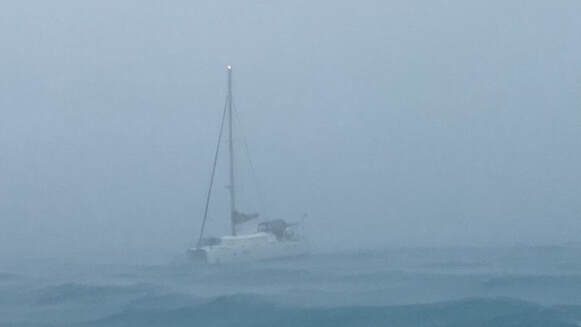
We wake to a lovely, calm and sunny morning and go exploring on the SUPs while the weather is fine. It starts to clag in around 11 am and it starts blowing and raining. Not much we can do but sit tight and spend the day on the boat, catching up on jobs and keeping an eye on the anchor and bouys. The wind picks up overnight and the following day would have to be the worst conditions we have ever had at anchor. Fortunately we have never experienced anything like this whilst underway. The low atolls, even with a thick covering of tall coconut palms, provide little in the way of protection and the wind wraps around the bottom of the motus (the thin strips of land on the windward side of the atoll). We had thunder, lightning, torrential rain and incredibly strong winds. There were short, sharp 1-2m+ wind waves pushing through the anchorage as well and bouncing everyone up and down like a hobby horse. It was blowing 30-40kts consistently for several hours and occasionally gusting to 50+ kts. The strongest I actually saw was 58kts but would not be surprised if it went higher, I was just too scared to look at the dials! We just sat and watched and listened and kept checking our position. I will admit that at the height of it I felt like curling up in the foetal position and sucking my thumb.
A boat nearby us broke their anchor bridle and lost a heap of chain through their windlass. We thought they were dragging as they were getting closer to us, but they managed to get it under control. They tried to call us on the radio to tell us what was happening, but with all the noise of the wind we didn’t even hear them. We decided to let out some more chain as well, which was pretty tricky given the blow, but in a brief “lull” of “only” 30tks managed to perform the manoeuvre. Given the circumstances we didn’t put any extra floats on our chain so our floats all disappeared below the surface, dragged down by the weight of the fully stretched anchor chain. Least of our problems at the moment.
It was pretty scary stuff, really uncomfortable, stressful and unsettling, but the anchor didn’t budge and we rode it out. We had been concerned that floating the chain might compromise our holding, but that wasn’t the case. The wind started to back off in the afternoon and 20kts now felt like a gentle breeze. It was a mentally exhausting day even though we didn’t get much done. Everything is wet, our feet are cold and wet. The bimini is leaking pretty badly as well, as the fabric has aged and lost its water-proofness. ITIKI has kept us safe again though and we are so grateful to have such a great boat and a fantastic anchor. I should mention that we also had the moral support of all the other boats around us too as everyone tuned into the same VHF channel and checked in on each other regularly as we all sat around on anchor watch, wondering what was coming next. Although we had some nasty conditions it seems it was even worse further east. We heard from friends in Raroia atoll that one boat got hit by lightning and lost all instruments. 70kts was the highest windspeed they recorded! Although I would not want to experience those conditions again it showed us what we and ITIKI are capable of managing.
Adrift in the storm
Not long after the wind had peaked, Warren from VA (another Helia) put the dinghy in the water to retrieve one of their brand new cocktail deck cushions which blew off the top of the boat. As he was picking it up a wave hit him and he flipped the dinghy. He was now sitting on the upturned hull of his dinghy, drifting through the anchorage in 25+kts. Somehow he managed to flip it back but of course he had lost a fuel tank and the cushion and the engine would not work so he was frantically paddling to try and reach one of the other boats in the anchorage, as the wind swept him onwards. He was already too far from us to retrieve him, Ollie was standing by with a rope, he missed that too and ended up at Sea Bella, the very last boat at the back of the anchorage. They looked after him well by all accounts and bought him back later when the wind had backed off.
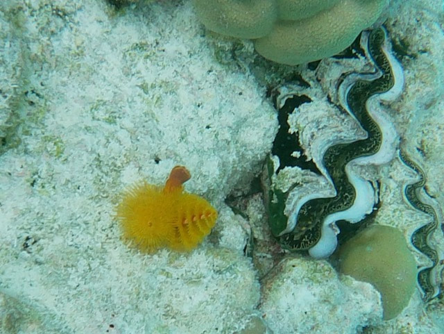
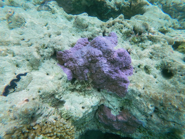
A few underwater scenes: The water is oh so clear!
Magical Makemo
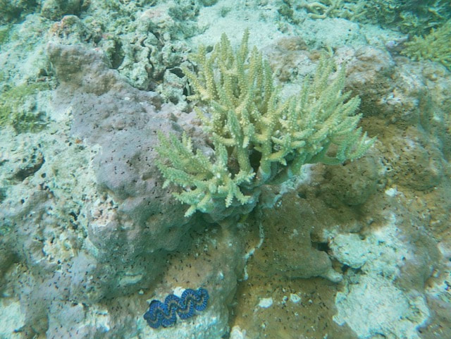
The following day our world was a different place. The weather is back to normal, paradise weather, sunny skies and gentle breeze. Ollie had spotted a bommie on the way down here that looked interesting and marked it on the map. We took off in the dinghy to try and find it, anchored the dinghy and went for a snorkel to explore. Ollie took his spear gun which made me slightly nervous but I am soon distracted by a really colourful reef, beautiful coral and lots of brightly coloured, fluorescent giant clams embedded in the rock. The water is crystal clear too. Its good to get back to doing something nice and normal after the trauma of the last couple of days.
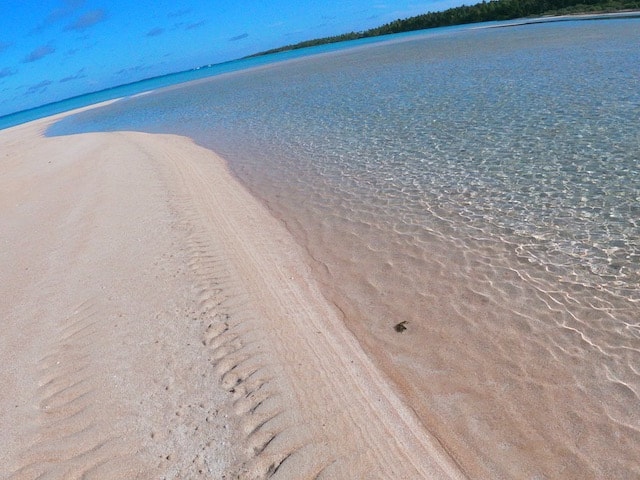
The next day we took a morning dinghy ride to the east of the anchorage where we found a sand-spit, beached the dinghy and went for a short walk. The sand is quite pink here, in fact it is pinker than more famous allegedly pink sand beaches that we have visited elsewhere, including the Madelennas in Italy. The sand is coarse, more like shell grit and your feet sink in in when you walk on it. Middle Makemo
Its time to head west, via the town anchorage, but Ollie on Mai Tai had a huge issue getting his anchor up. His chain has seemingly tied a clove hitch around a couple of rocks! He is on his own this takes quite a bit of manoeuvring to undo. The rocks and coral heads can be shaped like a mushroom so when your chain gets tucked underneath it can be very challenging to lift it. Keith went over in the dinghy to push Mai Tai this way and that, and it took about 30 minutes of fiddling to get it unravelled. We had a few minor issues getting our floats up, one of the fenders was split and full of water having been submerged during the Squash. Heading back to town we could essentially follow the track we came down on, but it only takes a meter or two difference in course and you can be on a bommie, so we still had to keep a good lookout.
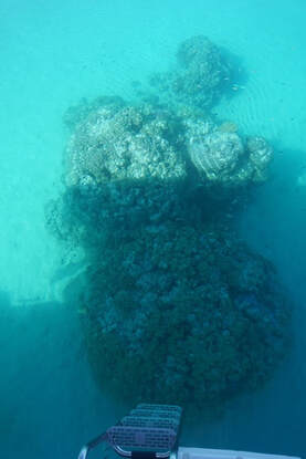 Our own personal bommie! Our own personal bommie!
We continued on the Makemo Central anchorage (Punaruka) which is 17nm from the main town. Again full concentration required to keep an eye out for bommies, particularly on our starboard side as the sun was coming from that direction. We anchored in close to shore amongst the bommies and our chain floating again went quite smoothly. The water is crystal clear and we have one bommie quite close to the back of the boat – checked the clearance with the boat hook - all good! It’s great to have a snorkelling spot so close to the back of the boat, in fact the water is so clear you dont even need to go in to see the fish! In the afternoon we went for a SUP and walked along the beautiful beach. There is a house here, a barking dog and some chickens running around. Quite a few hermit crabs walking along the beach too. They seem to have all the best shells!
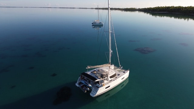
It is so still in the morning the water is like glass and the reflections are amazing. We decided to re-anchored back just slightly to the right to get more clearance on the bommies. As it was so clear we could see the marks where the anchor was dropped originally. Of course we are now swinging close to different bommies but we checked the depth again and clearance is good.
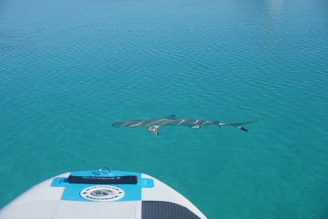
I went for a SUP to take some pictures of ITIKI and had some small reef tip sharks swimming around me and under the board. Ollie caught a fish from his dinghy so we enjoyed some sushi. We do have to be careful eating reef fish though as they can carry a toxin called Ciguatera, which can build up in your system and make you quite ill. Exit Stage Left
We left our anchorage at Punaruka mid-morning the next day, planning to anchor close to the Makemo West cut for the night and leave there early the next morning. The distance to our next atoll, Tahanea is only 66nm so if we leave early in the morning we can arrive in daylight. Great plan, however when we got to the western anchorages they were just no good. To the south of the cut there were 2 boats, and one of them contacted us by radio saying there was no clear room to anchor. We headed over to the north of the cut and took a look at 2 possible anchorages, but one had too many big bommies and the other was too deep to know what the bottom was. We went back over to the south anchorage to take a closer look, taking a shortcut across the channel of the cut and clipping a rock. Oooops! Left a little anti-foul paint on that one@
The south anchorage was even worse than the other two. The two boats that were there said that they were not anchored but had their chains wrapped around bommies. Hmmm not a great practice. We were between a bommie and a hard place, literally! It was too late to safely return to last night's anchorage so we conferred with Mai Tai and decided to head out of the cut and do a slow overnight passage to our next atoll, Tahanea. We stayed in close contact with Mai Tai throughout the afternoon and could see him most of the night as well. Our poor autopilot was working hard to steer given our slow speed, we were making 2-3 kts with just a reefed genoa. It is actually really hard to sail slowly when there is enough breeze to go at normal speed, but we definitely didn't want to arrive in darkness and have to wait around at the cut for enough light to go in. Makemo was our first atoll, first time navigating the infamous passes into and out of the atolls, first time anchoring around bommies and floating our chain and definitely the first time we have seen 58kts at anchor! All in all a great learning experience and we are ready to tackle the next atolls so stay tuned for more! Oa Pou & Nuku Hiva
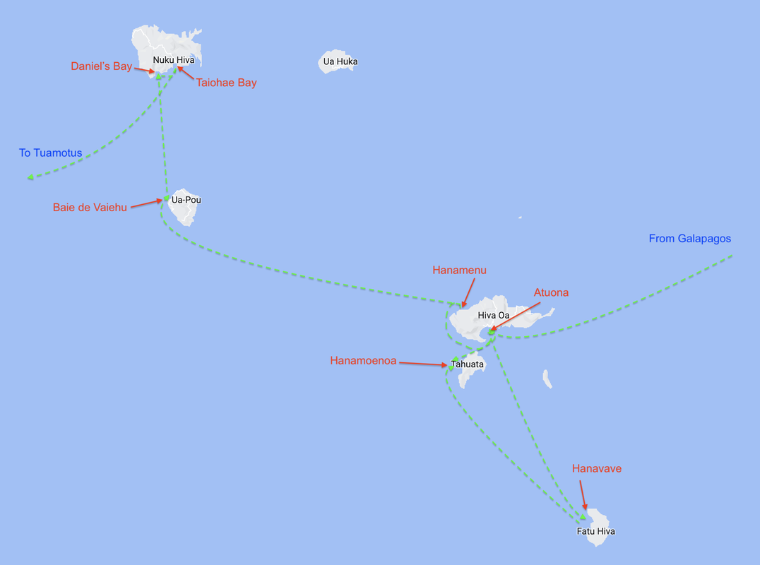
The northermost islands of the Marquesas are a little further away so we have an overnight passage to get to the next island, Ua Pou. After some dinner and rest we head off again at 9pm from Hanamenu, Hiva Oa. Had to motor for a good 4 hours before we got clear of the lee of the island and enough wind to hoist the kite. It was a little twisted from the loft pack, but Keith managed to sort it out and we got it up at around 1am in 10 kts. The repair looks fairly neat and strong. We held the kite overnight, gybing once. It was challenging at times as wind was light and shifty but it was good to see our Parasailor in action again.
OA POU ISLAND
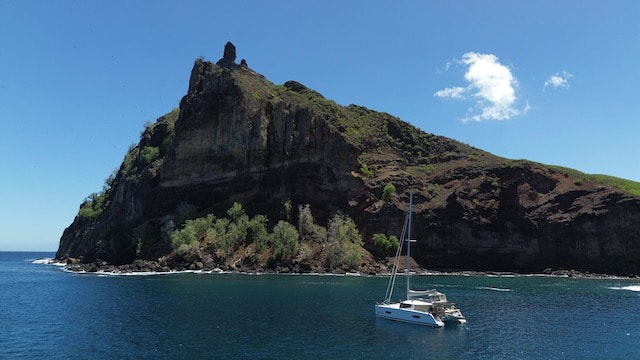
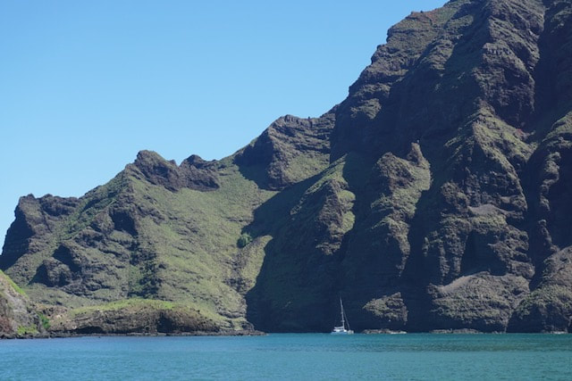
We decided to take a look along the west coast of the island of Oa Pou, rather than going around the east side to another town. As dawn broke we could see land, so nice and novel to do such a short overnight passage! Held the kite until we lost the wind in the shadow of the island and motored close in to take a look at anchorage options. Had huge pods of dolphins come and play with us twice as we travelled up the coast. We ended up in Baie de Vaiehu which is deserted and surrounded by a spectacular rocky shoreline. The water in the bay is a little murky, stirred up by the strong swell and with some foam. Later on we did a tour of the shoreline by dinghy. There are some amazing rock formations, blow holes and caves. Had cocktails to celebrate our anniversary and the last of our Martinique duck for dinner.
A couple of other boats arrived as did Mai Tai so we stayed an extra day, exploring the bay on our SUPs and catching up on news and drinks. NUKU HIVA ISLAND
From our anchorage at Oa Pou it’s a relatively short hop of 32nm to the final island we will visit in the Marquesas. We sailed across most of the way to Daniel’s Bay anchorage, with Mai Tai not far behind. There is quite a swell running, crashing into the rocky shoreline. The entrance to the bay is difficult to spot at first as there is a channel which doglegs around a headland. The channel is well charted and once inside the bay opens up to a spectacular vista. I have used the word “spectacular” a lot to describe the anchorages in the Marquesas I know! The towering mountain peaks that shelter these bays really certainly have the “wow” factor. Here we have all round protection and once we are tucked into our anchorage we can’t see the entrance anymore. The water is clean but is not crystal clear and we see a few small and curious reef sharks around the boat. We are anchored on the eastern side of the bay, where there is a beautiful white sand beach. West of us is another beach which is black sand. Not quite sure how that works!
HAKAUI WATERFALL
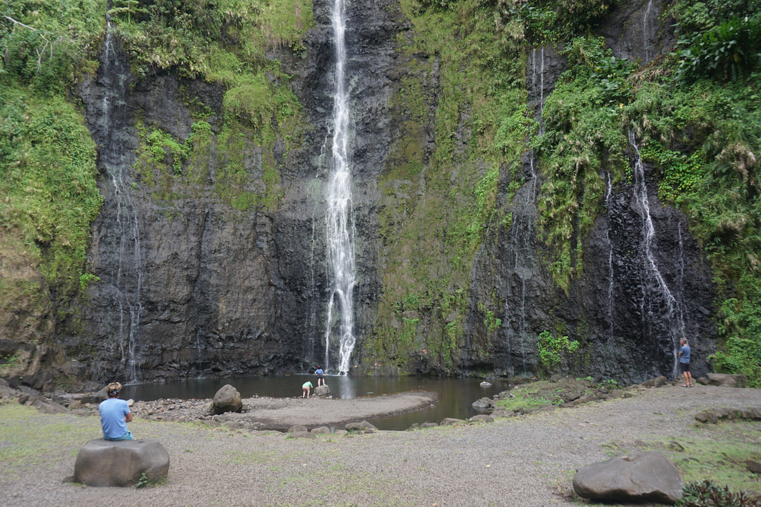
Dinghied over to Hakeata bay (the black sand beach) to take a walk to the Hakaui waterfall. There is a small fee to pay to access the trail which passes through private property, and the caretaker offers us some juicy fresh pamplemousse for the journey (with a promise of more on our return). Passed a small restaurant along the way so we booked in for lunch on way back. The walk was quite a rugged path, with several creek crossings so we are glad we wore our Tevas. We got to a sign that said “access interdit” and it took a while to figure out where the path went next. We had to cross the creek halfway before we could see the rock cairns up on the opposite bank. Keith slipped and dropped his last pair of good sunglasses into the rapids, cursing as they made their way downstream, never to bee seen again!
We have now entered a narrow part of the valley surrounded by high cliffs and looking up the sky through a very narrow opening. There is a reasonable risk of rock fall here and we were warned to stay quiet. There is a small rock pool and we can see the waterfall through a crevasse in the cliffs. We walk through the mud, around the pool and scramble up onto a rock to get a better view. You can swim through the canyon to get right under the waterfall, but we decide to watch some others do that instead, eating some pamplemousse to sustain us for the walk back. It's pretty juicy and messy but delicious. The walk back is a quicker as we know where we are going and we are ready for lunch at the local restaurant, Kua et Taikai. The food is delicious. Fresh Tuna marinated in herbs and river prawns, caught this morning and cooked in fresh coconut. We buy some bananas and mango from the restaurant. On the way back to the dinghy we stop at the caretaker’s house and as promised he gives us a heap of pamplemousse and limes. I fashion a makeshift shopping bag from a sarong – these suckers are pretty heavy! What will we have for sundowners tonight? You guessed it – pamplemousse gin. CIVILISATION AGAIN
After the weekend, and the May Day public holiday it was time for another taste of “civilisation”. Its only 4nm around to the main town of Nuku Hiva, Taiohae Bay. It was pretty bouncy coming out of the bay and still quite rough until we got into the lee off the headland at the east of the bay. The bay and anchorage is huge – there are plenty of boats and lots of room - quite a swell in the bay with surf breaking loudly on the shore. Getting into the dinghy is challenging with it bouncing around and we have to be super careful. We head ashore for a reccie, the supermarkets are dire in terms of fresh fruit and veg, but we find the fresh markets near the dock to be pretty good. We have also managed to organise haircuts, which is a real treat as those selfies are looking a bit shabby!
The dinghy dock is probably the worst I have ever seen. A dozen or so dinghies surging back and forth against the high concrete pier - ouch. The fishermen are cleaning their catch along pier and tossing the scraps into the water, which attracts a good number of fair sized reef tip sharks for a feeding frenzy. A couple of dinghies have swung quite close to the fishermen, so I hope they don’t return to find fermenting tuna in their boat! ROAD TOUR OF NUKU HIVA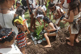 Tree planting Tree planting
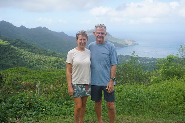
We have hired a car for the day to do a road trip with Ollie from Mai Tai, and up into the steep hills we go. The roads are windy and we climbed through numerous switch backs. There are regular stops for panoramic views of the bay, and we can almost see ITIKI! In the next valley we come to a village, where there is some kind of school carnival taking place. All the kids and teachers are in colourful, traditional costumes with different groups and themes. We watched a tree planting ceremony which has accompanied by some drumming and traditional singing, all in Marquesan language. This was followed by some dance routines, story telling different teams taking turns. We stayed and watched for a while - such a lovely, chance encounter.
Back up into the hills again and over the next ridge we came down into the valley to visit a historical site, a ceremonial meeting area of which there are a few remains. The valuable items have been removed but there are some replicas in place. Continued on to another small village, with a lovely church and a black sand beach. Hatiheu Bay is wide looks like a good anchorage surrounded by dramatic cliffs and rock formations along the shore. We stopped for lunch at the only restaurant, Keith had goat and Ollie had pork – both suspected road kill. I had curried fish, much better choice.
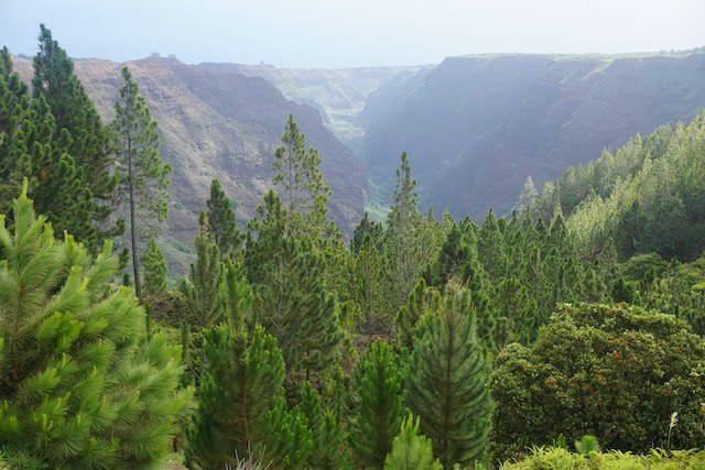
Up into the hills again and took another turn off towards the airport for some more winding, switchback roads. Stopped at one view point and then continued on to another, called the Grand Canyon. We are now at the highest point on the island and it is cold, windy and damp up in the clouds. We can see down along a vast canyon into the middle of the island. It is lined with fir trees and all very green and fertile.
On the way back to we stopped via the one supermarket we had not yet visited and were quite excited to find Aussie WeetBix! Yee haa! Only other cruisers truly understand the excitement and significance of such a supermarket find...
When we got back we found our dinghy had been moved and the prop was smashing on the concrete ramp. Great! One last stop to get dinghy fuel, pick up a gas bottle and load all of our shopping (mostly Ollie’s beer) into the dinghy and bounce our way back to our boats, thankfully getting all on board without losing any people or goods. We now have to say “au revoir” to The Marquesas as the clock is ticking on our 90 day visas and there is so much more to see. Tomorrow we have an early start to make the 503nm to Makemo, our first atoll in the Tuamotus. |
AuthorAfter more than 5 years of (minus time off for Covid) and more than 27,000nm Lynda has finally got the hang of this cruising life Archives
June 2024
Categories |


 RSS Feed
