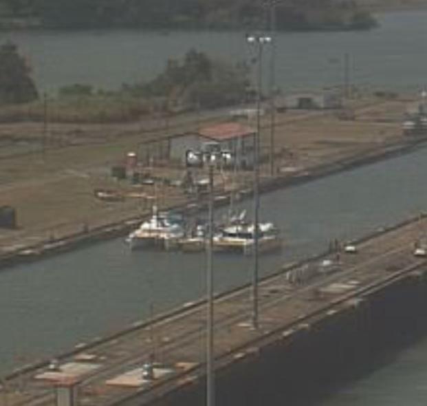
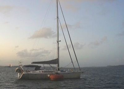
Grainy webcam of ITIKI, Illimite and Mai Tai in the Gatun locks
The Panama Canal, the path between the Atlantic and Pacific oceans, a channel between the North and South American continents. A marvel of “modern” engineering and a real thrill to have the opportunity to transit in our own yacht!
We left Shelter Bay Marina with an air of nervous anticipation, we were well prepared and had an experienced crew on board but an 11th hour hiccup almost put an end to our well planned transit. Read on to find out what happened in that gut wrenching moment. 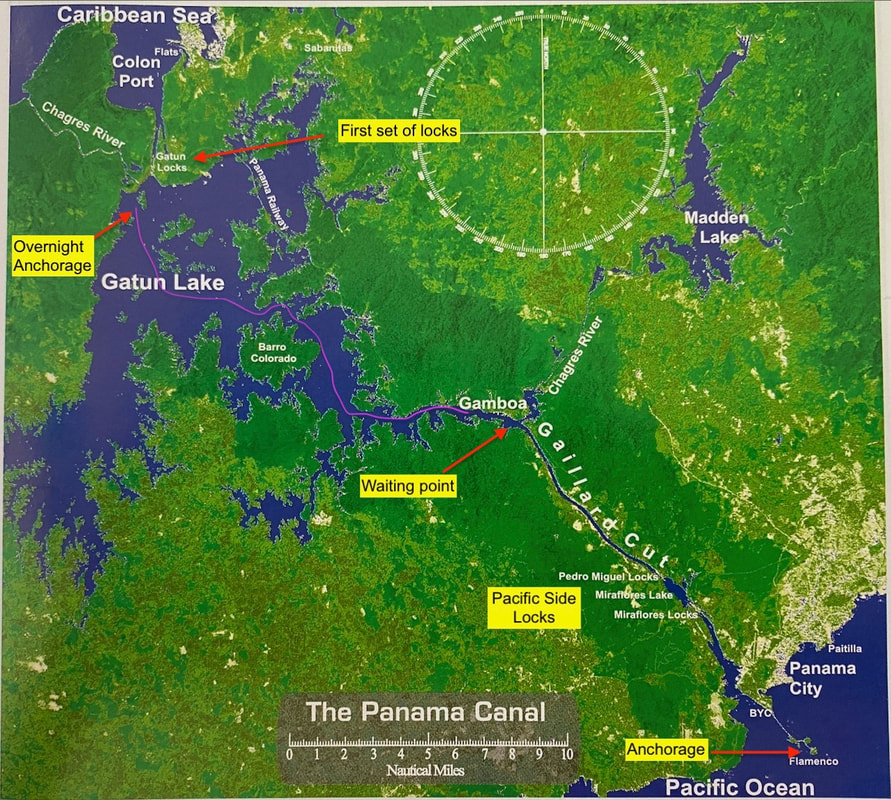
The Path Between the Seas
A bit about the Panama Canal
The Panama Canal opened in 1915, having been built and initially managed by the USA, who basically had sovereignty over the canal and several miles either side of it. It has remained almost continuously operating since then. From 1977 to 1997 the management of the canal was progressively handed over to the Panamanian government. Panama used to be a province of Columbia, but peacefully seceded in the early 1900s in order to secure American support for completion and management of the Panama Canal. Panama remains a neutral country with only defensive forces, which given the significance of the canal is a crucial point. Ships from any country can go through the canal - we learn that an Iranian naval vessel transited the week before us.
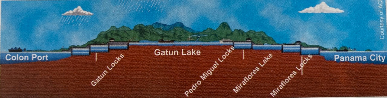
Canal in profile
The Panama Canal provides important access for shipping between the west and east coasts of America and of course between Europe and Asia with ships able to transit in both directions. It is the prime source of income for Panama, and because of the canal Panama is a key International shipping hub, connecting North and South America. There is continuous maintenance going on to ensure the canal operates smoothly 24/7 and major works are always in progress to add more locks, widen the narrow parts of the canal (including the Gaillard Cut) and further increase the capacity of the Canal.
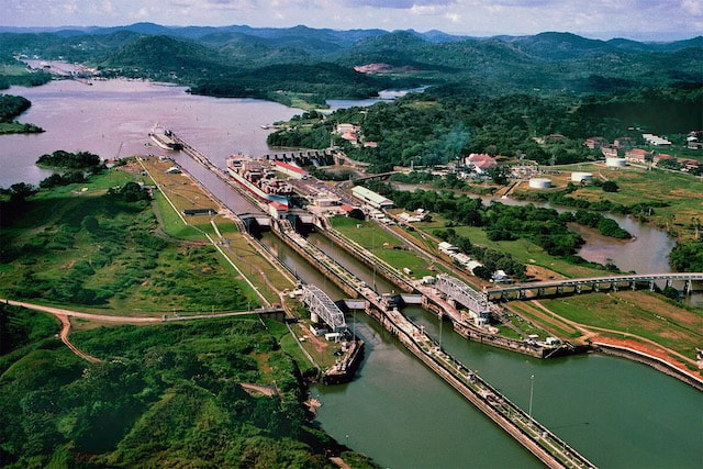
Miaflores locks, Pacific side
For ITIKI the Canal is the last physical barrier between us and our “backyard” of the Pacific Ocean. For any cruiser the transit of the canal is a big deal, exciting and a little daunting at the same time, with of course some bureaucracy and logistics to get through. We chose to use a canal Agent, Erick Galvez of Centenanrio, to smooth our way through this process and we are glad we did. It takes the stress and work out of figuring out the system, making payments, scheduling and dealing with Spanish speaking officials. The Agents know the system and know how to work with it, although they certainly can't control everything.
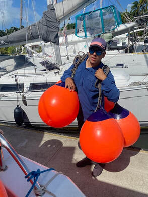 Here are your fenders! Here are your fenders!
Every yacht that goes through the canal needs to have 4 sets of heavy mooring lines to use to attach to the lock walls. Large fenders are also required and both lines and fenders can be rented from the canal agent. We also need to have 4 line-handlers on board. There is a great network of cruisers around Shelter Bay area who are ready and willing to “pay it forward” and do a transit ahead of their own to help out others. We were fortunate to have new friends and fellow cruisers as “line handlers” to help us out as well as sharing the adventure. A big shout out to Tad and Robyn of SV Bisou, fellow Helia 44 owners who line-handled for us, and had already done it once before. Also to Morrie, our crew for the leg to Galapagos, who had also transited on another yacht. It seems Keith and I the only “Canal virgins” on this trip. We were also delighted to have our well chosen boat buddies - Ollie and the team on Mai Tai (a Lagoon 40) coming through the Canal with us. This turned out to be a very good choice of transit companion, but more on that later.
Getting Ready
The transit process starts with a boat being measured. After leaving Guna Yala we stopped into Shelter Bay Marina which is located at the entrance to the Port of Colon, the gateway to the Panama Canal. Our Agent has organised a time slot for ITIKI to be officially measured. Whilst it is possible to be measured in The (New) Flats Anchorage, its much easier for the busy admeasurer to just walk along the dock to the next boat. The process itself as simple as there are only two size categories: < 65’ and > 65’ and as a 44’ cat we easily inside the first category. The admeasurer outlines the transit process and provide some good advice for the skipper. We will have an advisor on board who will sit with the skipper, and work with the advisors on the other yachts in the ‘raft up’ as well as the Canal operators to get us through safely. Once measured, we book a transit for 14 February via our agent, along with our boat buddy Mai Tai.
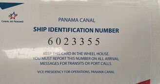
Our ticket to ride!
Off to Bocos
With those boxes ticked we have some time to head west to Bocos de Toro for a few days, and return with plenty of time for our transit.
We had some "throttle issues" we discovered on our way back from Bocos. We were confident these were now fixed and the engines were working well. Keith also had change the oil filters with Ollie before we left for Bocos and the engines had been starting and running smoothly for over a week now. A few days before our transit date we were back in Shelter Bay Marina, feeling pretty relaxed, when I got a message from our agent saying that our transit date was moved forward by one day! It would now be on 13 February - unlucky for some but fortunately we are not superstitious…
But now we had to get our skates on! I spent the day cooking up a couple of evening meals which would give me more time as we went through the Canal. The advisors expect “proper meals” and rumours abound about unhappy advises calling out for Uber eats at Skipper’s expense if he doesn’t like what’s on offer. Our agent even provided some pictures of what proper meals look like! I think I was more stressed about this than any other aspects of our transit. I also have our line handlers and crew to feed for two days.
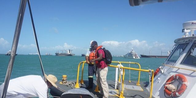
Our Canal Adviser Guillaime stepping aboard
The Big Day Has Come
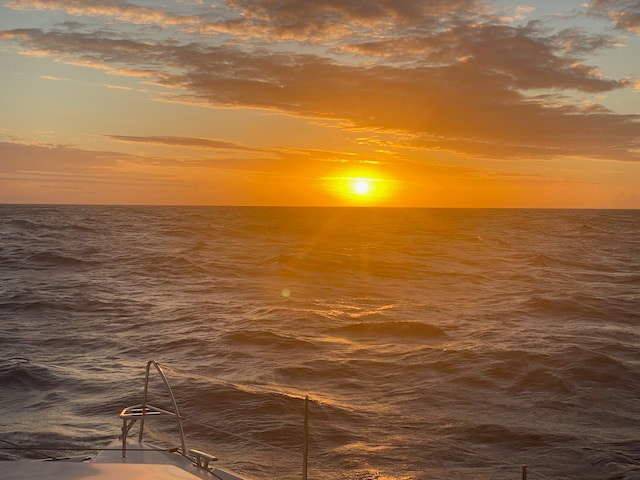
And so the moment has arrived. There are three yachts going through today, two cats and a mono. Cristobal station called us on channel 12 to confirm we should head out to The Flats (Anchorage) and wait for the advisor who would step on board at 2:30 pm. So off we go, we anchor and wait, it’s blowing 20 kn and its not the nicest of anchorages but the advisor, Guillame, is on time and with some great manoeuvrings from the pilot boat he jumps aboard. Gentlemen, start your engines…
Then it comes.... The "OMG that’s all we need” moment… We are about to transit THE PANAMA CANAL, busiest shipping channel in the world and the @#@$%& STARBOARD ENGINE WOULD NOT START!
It spluttered and coughed but would just not catch. Keith quickly started the port one and that was fine. After our “double trouble” with the throttles, that was a relief. We try to stay calm in front of the advisor and I quickly messaged Ollie our boat buddy. At this point we were quite sure that the advisor would pull the pin on our transit. Having a mechanical problem transiting the Panama Canal would have a knock on effect for the other vessels and screw up their all important schedules. Fines would also be issued and deposits lost and we would have to start the process again, join the back of the queue! We played it down as much as we could… “yeah bubbles in a few lines will work their way through” … act casual it’s no big deal… We quickly upped anchor and got going and as we were making reasonable speed with one engine, the advisor seems happy to continue. Perhaps he also had his mind on that “proper” meal. Phew!
We liaise with Ollie from Mai Tai who as luck would have it is an amazing, highly experienced “engine mechanic to the stars” with the blood of of McGyver in his veins! What a great choice of boat buddy! Meanwhile the advisors confer and we agree that as our Port engine is working fine we will be the port side of the yacht raft. The mono will be in the middle and Mai Tai will be on the Starboard side.
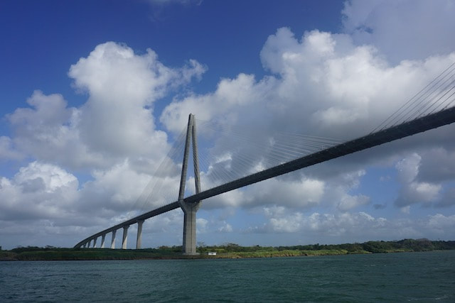
We’ll head off separately towards the Canal entrance passing under the Gatun Bridge, which looks a little like the ANZAC Bridge in Sydney. In front of the entrance to the first set of locks we start to form the raft. Mai Tai and the mono join first but they struggle with a strong beam-on wind. Once they straighten up we can join them but the professional line handlers on the mono make a meal of it and we copped a nasty scratch in our gelcoat. Into the Gatun Locks
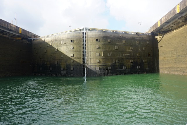
Finally we are moving as one and heading towards the first lock. Yachts enter the first set of locks behind a freighter and our lock buddy is already in place. Freighters don’t use their engines to move them through the locks. They are towed through by locomotives on rails on either side of the locks lateral walls. This means that there is no prop wash for the boats behind them. There is barely enough room for a fender between the side of the freighter and the walls. Panamax class ships are built to fit exactly in the Panama Canal with no space wasted.
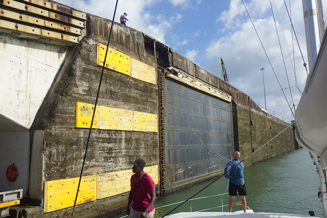
Keep away from those walls!
The linesman on the shore throw us the messenger lines. These are lightweight hemp lines that have weighted monkey fists on the ends, and land on the foredeck (eventually). Our heavy mooring lines, supplied by our agent, are already in place and we attach them to the messenger lines so they can be pulled up by the linesmen and placed on cleats high above us on the lock wall. And then the gates close behind us. The water level starts to rise and our line handlers gently take up the slack on our lines, keeping the raft centred in the lock. Although we have plenty of fenders out, we really don’t want to bounce off those nasty looking concrete walls!
Action man!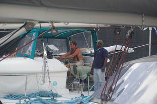 Ollie at the helm of Mai Tai Ollie at the helm of Mai Tai
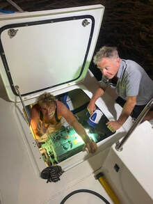
As soon as the gates of the first lock close Ollie springs into action, hops across the mono and onto ITIKI, clutching a length of fuel line and with a gleam of confident determination in his eye. The clock is ticking… With the calm air of an ER surgeon, Ollie directs Keith to place a jerrycan in the engine bay, find a cable tie and a weight that will fit through the opening of the jerrycan. Keith watches in awe as Ollie adeptly McGyvers up a system to take fuel directly out of the jerrycan into the engine, bypassing the fuel filters, which are the suspected cause of the problem. Meanwhile the line handlers, Morrie, Tad and Robyn do their stuff while I try to keep the advisor amused and distracted in the skipper’s absence. The water level rises in the lock, which takes about 15 minutes. Keith fires up the Starboard engine and voila! It works like a charm! In the blink of an eye Ollie is back to Mai Tai in time to drive the raft to the next lock. Clever man!
Once the lock is full and we have reached the top, the gates open into the next lock. We are to follow the freighter in front of us and the instructions from our advisor. The shore linesman lower our mooring lines to us. We hold the messenger lines gently as we motor through to the next lock, whilst they walk along the wall beside us, holding the other ends. When we are in position they take the mooring lines upwards again to the high lock wall and cleat them off again. The gates close behind us and up we go again. There are essentially two boats in each lock, the freighter and our yacht-raft. If we weren’t here there would probably be two small freighters, so they are probably not making as much money from this transit as they could be.
Stand clear, doors closing
The advisors on each of the boats don’t seem to be communicating very well and the coordination of the raft process and the movements from lock to lock is left to the skippers. The advisor on the middle boat should be taking the lead, but we are not even sure we know which guy is their advisor. At one stage Mai Tai gets a bit too close to the starboard of wall and is struggling to drive the raft to port. We only have a port engine on which doesn’t help matters. Our line handlers try to compensate by taking up extra slack to pull the raft across to port.
We have one more lock to go so we repeat the same process one more time to come up to the level of the lake and once the freighter is out and clear we can emerge from the locks and into Lake Gatun. It’s now getting close to 4:30 in the afternoon. The freighter will continue onto the Pacific side and complete it’s transit tonight. Because we are not fast enough to keep up, and don’t have professional crew, we will stop and spend the night in the lake before continuing on the next morning. I prepare an early dinner of spag bol for the canal advisor who is ready for his “proper meal” - I wonder how often they get spag bol? He will get off tonight and we will get a new advisor morning to take us down through the Pacific side locks.
Rafted to Mai Tai in Lake Gatun
The Lake between the Americas
Lake Gatun was formed by damming of the Chagris River and catches the substantial rains that fall through this mountainous area in the wet season. Why are there locks? Why not just go through at sea level, as the original French consortium had planned? Just like the Suez, right? Well, its all about the tides. On the Atlantic side the tides are in the order of 40 cm between high and low. On the Pacific side however, the difference between high and low can be up to 4 metres. The other factor of course is the variation in the water level in the Gatun Lake, between wet and dry season. All of this needs to be managed. The flooding of the lake is part of managing this tidal difference, but it also avoided a much more extensive excavation and moving of mountains that a sea level canal would have required.
There are some super large ship’s buoys in the lake and we head towards them. As Ollie needs to do some more work on our engines the advisors agree we can raft up with Mai Tai overnight. It’s not allowed to use the dinghy in the lake so we can’t take separate buoys and have Ollie make a house call! Swimming is not permitted either and rumours of crocodiles abound in case anyone is tempted.
Mai Tai attaches to the bouy first. Because of the size of the buoy, yachts moor alongside them rather than taking a line from the bow and swinging around. They take a line from a mid-ships’ cleat to to start with, and then fore and after lines as well. Evan jumps onto the buoy to catch the line as their first lasso attempt missed. I think he saw this on a YouTube video.
Illimite alongside a buoy
Meanwhile our engine woes continue. The jerrycan that was feeding our starboard engine is now empty and the engine has conked out. Its not that we have used 25L of diesel in such a a short time, but just that the excess fuel return has been going back to the main tank rather than into the jerry, so the jerrycan ran out very quickly. We now have more fuel in the main tank than when we started! We make an attempt to come alongside Mai Tai on one engine but it failed. It is quite windy in the lake. Rather than risk a failed second attempt, Keith hands the helm to Tad (great to have another Helia skipper board) and grabs another jerrycan of fuel to replace the empty one. We are back in business with 2 engines and successfully complete the raft up process.
 Ollie "McGyver" Maxwell fitting fuel bypass V2.0 Ollie "McGyver" Maxwell fitting fuel bypass V2.0
The pilot boat comes by and picks up the advisors and Ollie is back on board ITIKI. Before we know it his prosthetic leg is on the deck with the tool box and he is down in the engine bay. This time he upgrades our fueling system to V2.0, with the fuel return coming back to the same jerrycan so we don’t run dry so quickly.
We have our own “proper meal” of curried chicken saving a portion for tomorrow’s advisor, and a celebratory drink. We are halfway between the earths two biggest oceans, floating in the lake between north and south America watching massive cargo ships go by all night. How incredible is that! And now for the Pacific Side
We are up early to find the boat covered in ash from a fire that has been burning ashore. As the lake is freshwater we can use the “seawater” wash to clean the deck - Nice one! The new advisor arrives at 7 am and there is no mention of yesterday’s engine problems. The starboard engine starts perfectly. We have 20 nautical miles to travel across the lake, through the Culebra or Gaillard Cut to the entrance of the next set of locks. Our advisor, Harold, is quite a talker and is full of interesting information and history about the canal. He has prepared a series of quiz questions which he poses over the course of the day. I have included these to make sure you were listening!
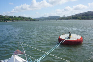
Harold sets a cracking pace which will get us to our meeting point at Gamboa, well ahead of schedule. We follow the clearly marked shipping channel watching huge Panamax freighters heading in both directions. It’s the smaller tugs though that cause us the most grief, as their bow waves hit us side on, sending the dish rack onto the floor on one occasion. We arrive well ahead of time and use one of our large mooring lines to the lasso the cleat on a large buoy so we can sit and wait. Mai Tai comes next and finally Illimite, our mono friends. We are also waiting for our new lock body, a freighter that is making its way from Gatun locks to join us in the next set of locks. This time they will be behind us. This is to avoid the risk of them being pushed back onto our raft as the lock gates open on Pacific side and salt water meets fresh water.
Waiting at Gamboa
From Gamboa we part company with the Chagris River and what has been the mainly natural path of the river. The Chagris continues north and we head south east and enter the Gaillard Cut. It’s 7.5 nautical miles to our next lock, the Pedro Miguel lock. The Gaillard Cut (formerly known as the Culebra Cut - culebra means snake) is where the major portion of excavation for the Canal took place. It was carved through the rock and shale of the Continental divide and is currently 152 m wide. We pass Gold Hill with its pyramid shaped, stepped-sides and golden yellow vegetation, and continue on under Centenario Bridge before arriving at the entrance to the Pedro Miguel lock. The Gaillard cut is the section most susceptible to landslides and the largest one which occurred in 1915 was the only one to ever cause the canal to close.
First quiz question: How many times has the Panama Canal completely closed to traffic? Tackling the Pacific side locks
Our raft up procedure goes much more smoothly this time and we are thankful there is no wind to push us around, and that we have 2 engines. We entered the Pedro Miguel lock in unison and this time the advisor on the centre yacht introduces himself and coordinates with the other advisors from the yacht foredeck. Then our lock buddy snuggles in behind us, it’s a huge brown, steel hulk looming over our helm station and dwarfing our little raft. I hope this is the closest will ever come to the front of such a huge behemoth!
In these locks we will be taken down to the level of the Pacific Ocean so to start with we are level with the top of the lock walls. The messenger lines with monkey fists arrive on our foredeck and we send across our mooring lines. The freighter is towering over the canal walls and we see small wooden boats take lines which are lowered from the ship to the waterline level. They then convey these to the shore to be attached to the little trains. 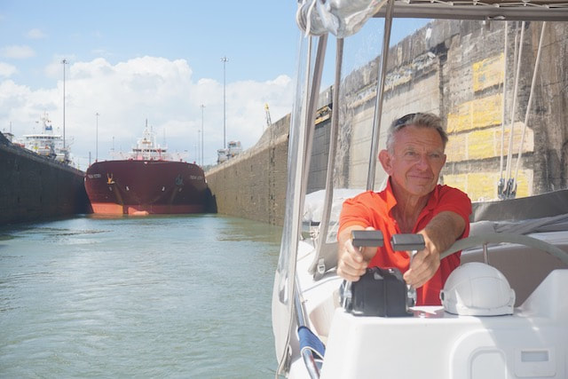
The water level starts to go down and this time the lines are eased as we go. I have decided to have a go as a line handler as I am not too busy making proper meals, tea and coffee etc. I take care of our forward line. The lead advisor calls out commands and blows his whistle to get attention. Harold continues chatting away and the quiz continues:
How many screws are there in the gates of the Pedro Miguel lock? We reach the bottom, and the gates open in front of us and we (the ITIKI-Illimite-MaiTai raft) move out of the lock and into the Miaflores lake. We have 2 nm to traverse to reach the final two locks. Next quiz question: Why is there a gap between the Pedro Miguel and Miaflores locks?
We reach the end of the first of the Miaflores locks and have some time for photos while our lock buddy the freighter catches up. He fills the entire lock and we have no chance of seeing the gates close behind us. The water level goes down over about 10 minutes, and then the gates open into the next and final lock. We motor forwarded holding the messenger lines before the mooring lines are sent to shore for the final time. Once again the water level goes down and the gates open. And just like that we are in the Pacific!!
Quiz question: Lake water is used to fill the locks. What percentage of the lock water is recycled? 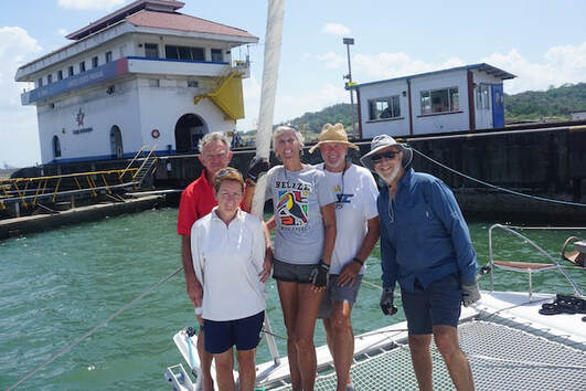
Team ITIKI
Somehow I expected a bit more of a fanfare, streamers, balloons, marching bands - a bit like the olden days (ie the 70s) when The Empress of Australia left Devonport for the far flung city of Melbourne…
Instead we retrieve the mooring lines, untie the messenger lines and they are whisked away. We move off to port, release the raft and we are free! The McGyver’s V2.0 engine repair is working well - the final fix will be done when we find a calm anchorage somewhere. For the time being with the fuel return going back into the jerrycan the supply will last much longer. It’s another 4nm of motoring, passing under the Bridge of the Americas (which looks remarkably like the Sydney Harbour Bridge) before we reach the Balboa Yacht Club. Two chaps in a panga come out to greet us and we return our rented orange fenders and blue mooring lines, tipping them the mandatory $12. 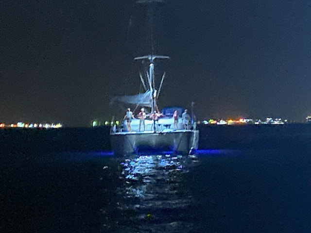
Foredeck celebrations on Mai Tai
The canal advisors on the other yachts are quickly picked up by pilot boats, but somehow Harold is left cooling his heels for another 10 minutes, while we circle around. Maybe he is in someone’s bad books. Finally he is off and we can drop anchor outside La Playita Marina. It’s a bouncy anchorage with a lot of local traffic, with tourist and pilot boats creating wash as they past too close and too fast. We can relax now though and enjoy an evening meal with the crew and celebrate or successful canal transit. Meanwhile the crew of Mai Tai are also celebrating and provide some entertainment with their disco lights and dancing on the foredeck.
Oh so what about the answers to those quiz questions? Send in your answers in the comments section and we will see how well you score!

1 Comment
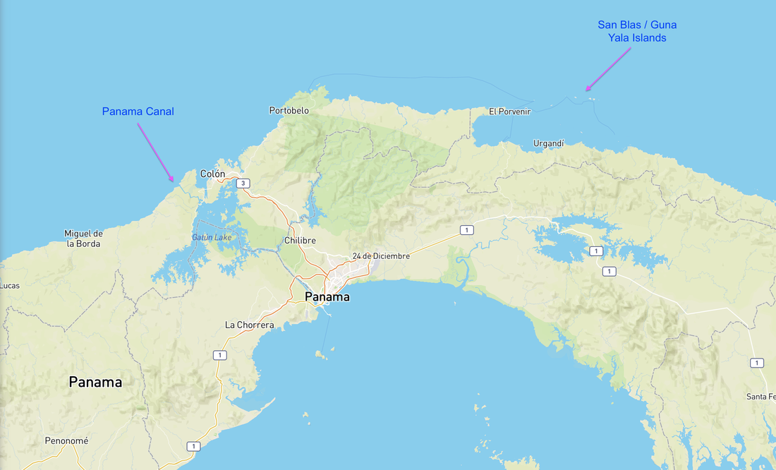
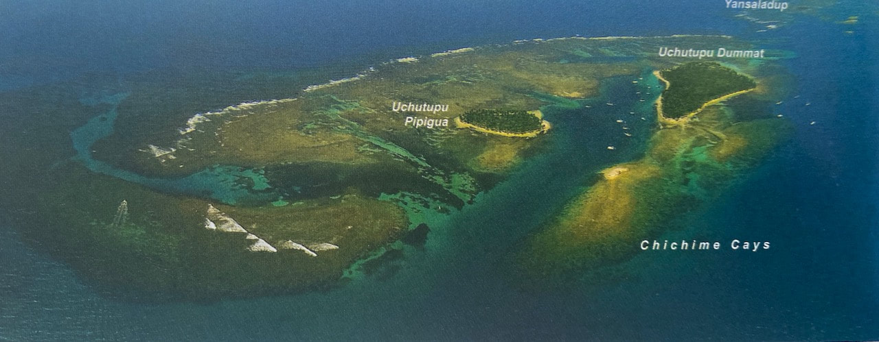
The San Blas islands are a vast archipelago stretching west along Panama’s eastern Caribbean coast, from the Columbian border. These islands are a popular stopover for cruisers planning to go through the canal, a most beautiful, peaceful and unique part of the world. Nowadays the islands, and the nearby mainland, are known as Guna Yala, as they are home to the indigenous Guna Indians, who have the best preserved culture and traditions of all of the South American Indians. The Guna people are a autonomous, and control this part of Panama, both the islands and the associated mainland of dense and mountainous tropical rainforest. The Guna are a matrilineal society, continuing to live in a traditional way. They live simply, often without electricity or running water and rely on fishing and coconut farming for food and trading.
Typical San Blas scenery
Cruisers choose to arrive either in of 2 locations: the Southernmost part of the region, and check in at the town of Olbadia on the Darien Peninsula. This area is known for its lightning storms and conditions can be tough getting down this way. Legend has it that Columbian drug runners frequent the area and there are no roads into the town. Whilst this gives you the option to drop into some of the less visited islands as you make your way west, it’s also a bit more of a (sometimes windward) schlep to make your way along the island chain. The other option is to arrive into the island of Porvenir, on the western end of the island group. This is close to the more popular and visited islands and cays, as well as being closer to Shelter Bay the take off point for the Panama Canal passage. The downside of this option is the need to use an agent to get a cruising permit as these are not available at the check in port. We chose the second option as this would give us more time in the idyllic north-western islands, and less time on the move.
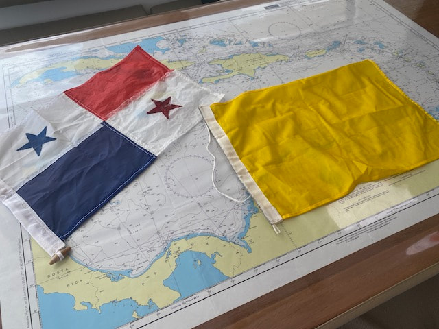
Our home-made Panama flag
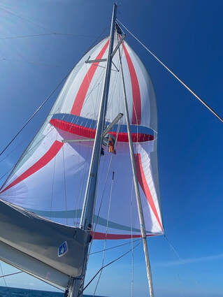 Held the Parasailor all the way Held the Parasailor all the way
Santa Marta to Porvenir
Having left Martinique for the 3 day journey to Los Roques on my birthday last year, it is appropriate that we leave Santa Marta for the 304nm, 2.5 day journey to Porvenir, Panama on Keith’s birthday (2 January, 2023). Got away around 9:20am, after SV Cinnamon and before WildThing2, both are going via Cartagena so we can only share the first part of the journey along the Columbian Coast. Once we got out into the breeze line we decided to put the kite up. Had 2+m following seas, with big rogues wave4s every now and again and wind in the low 20s with the occasional gust going higher. I was feeling a bit queezy after a month in a marina, so I took half a Travacalm, which of course made me tired, so I had to have a nap. In the early afternoon I woke to a big swell pushing us along nicely and came up to the helm to a surreal scene. ITIKI was completely surrounded by rough, dirty brown water. Had Keith taken a wrong turn and ended up in the Amazon? No - we were passing Baranquilla and the mouth of the infamous Magdalena River which is well known for spewing its muddy, brown water and debris into the sea. Fortunately we did not see too much in the way of large flotsam which after heavy rains can apparently include large tree trunks and the odd cow! We continued on through the night with the kite up and it was easy to manage. Keith had about 4 hours of strongish winds and high seas during his watch and got max speed for our journey of 15.7kts surfing down a wave. It had backed off by the time I came on which was just as well.Santa Marta to Porvenir Having left Martinique for the 3 day journey to Los Roques on my birthday last year, it is appropriate that we leave Santa Marta for the 304nm, 2.5 day journey to Porvenir, Panama on Keith’s birthday (2 January, 2023). Got away around 9:20am, after SV Cinnamon and before WildThing2, both are going via Cartagena so we can only share the first part of the journey along the Columbian Coast. Once we got out into the breeze line we decided to put the kite up. Had 2+m following seas, with big rogues waves every now and again and wind in the low 20s with the occasional gust going higher. I was feeling a bit queezy after a month in a marina, so I took half a Travacalm, which of course made me tired, so I had to have a nap. In the early afternoon I woke to a big swell pushing us along nicely and came up to the helm to a surreal scene. ITIKI was completely surrounded by rough, dirty brown water. Had Keith taken a wrong turn and ended up in the Amazon? No - we were passing Baranquilla and the mouth of the infamous Magdalena River which is well known for spewing its muddy, brown water and debris into the sea. Fortunately we did not see too much in the way of large flotsam which after heavy rains can apparently include large tree trunks and the odd cow! We continued on through the night with the kite up and it was easy to manage. Keith had about 4 hours of strongish winds and high seas during his watch and got max speed for our journey of 15.7kts surfing down a wave. It had backed off by the time I came on which was just as well. 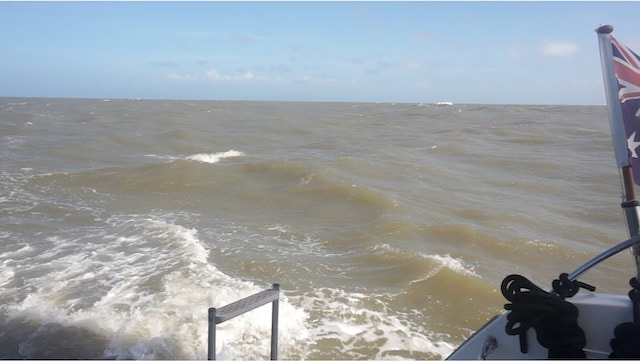
Outflow from the Magdalena River
The kite is doing great as it just looks after itself, but we can’t reef it or slow down without changing sails, so our arrival is set to be in the middle of the night! About 12 hours out the wind has settled into +/-15kts and seas are nice and flat. We come into the anchorage around 1am on Friday 4th. Fortunately there is good moonlight and there are 2 other boats here. We drop anchor to the west of the runway and after a tot of rum, hit the hay.
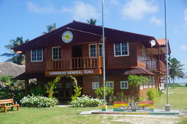
Guna Yala headquarters
Checking in
We wake to the sound of a small breaking wave not far from the back of the boat, where there is a small reef. Not a problem but we would not have wanted to have put any more chain out! SV Voodoo, 70’ mono, arrive around 9am and anchor to the east of us. They left Santa Marta a few hours after us and decided to slow down to arrive in daylight. We have a quick chat over the radio and then head ashore to check in. The process is easy and used as a training session going on - all available personnel look on as the head honcho gives a running commentary in Spanish. Passports stamped and police checks done we have our pictures taken with the anchorage in the background. Then we go to the Congresso to get the local Guna Yala anchoring permit (US$60). The Congresso is the Guna Yala grand council who govern the area via a series of local councils. Before heading off we, took the dinghy over to a nearby small island to get a local SIM card so we could get internet connection.
When we came to lift the anchor the bridle had wrapped itself 3 times around and around the chain – it was so bad I couldn’t get it into the anchor well. It takes a bit of manoeuvring as Keith has to unravel it while I keep the boat head to wind. Voodoo get away before us, wondering what on earth we are doing, and we meet them again over at Chimiche Cays anchorage. Quite a few boats here but somehow there is room. What a lovely place. We have a BBQ and an early night.
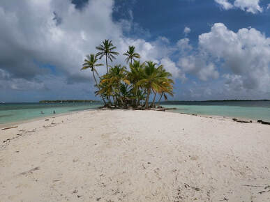
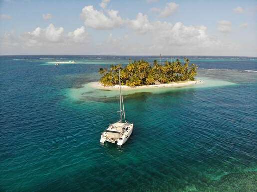
Arial view of Chichime Cays, typical of the many Cays in Guna Yala
Highlights of Guna Yala
We spent 2 ½ weeks working our way clockwise around the set of cays at the western end of Guna Yala. Each of the cays is a little different but generally each of them consisted of a small group of sand islets, stabilised by the roots of the thick covering of coconut trees, and protected by fringing reefs. A little like Tobago Cays in the eastern Caribbean, but there are lots of them. The sand islands are low but the dense stands of tall trees provide good protection from the prevailing winds and the leeward sides can be well sheltered anchorages, particularly on the larger islands. The reefs provide good protection from the swell and the waters abound with sea life, corals and tropical fish, reef sharks and turtles. Sadly as sea levels rise these cays will begin to disappear.
ITIKI at Coco Banderras
Chilling out
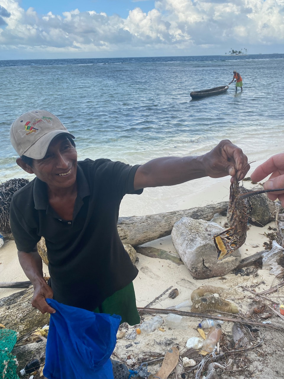
As we move from island to island and cay to cay, we continue to marvel at the stunning scenery. White sand beaches, coconut trees, crystal clear water and fresh fish. The water colour is the most amazing turquoise colour. Not much to do but enjoy swimming and SUPping – although we are down one paddle board as Keith’s has a terminal leak. There are also plenty of reefs to go snorkelling and we find a variety of colourful coral and lots of tropical fish. We take ITIKI to snorkel at Dog Island Wreck, a small and shallow sunken wreck nearby a beach resort. Here we find some colourful coral on the walls of the wreck and loads of tropical fish darting in and out. It’s cool to be able to see the outline of a ship under all that sea-life. Swimming the anchor at Coco Banderras anchorage I looked around saw a reef shark about my size swimming along the shoreline in shallow water. Hmmm – I know they are not dangerous but that shape, and the music… I swim quite quickly back to the boat with as little splashing as possible. Regular supply boats come into the anchorages so it is possible to buy fresh fruit and vegetables to keep us going. That means we don’t have to rush off to the mainland to find a town with a shop. Fresh fish and lobster are also on offer from the local fishermen. 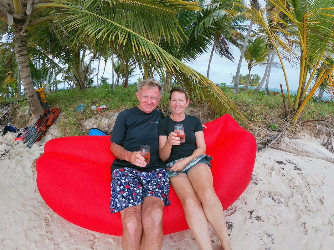
Santa Marta crew reunion
It was lovely to catch up with fellow cruisers from the Santa Marta Christmas crew at some of our stops - just relax, have fun, share drinks on the beach and plenty of laughs. Everyone is slowly making their way west as we all head towards the Pacific. Mai Tai has arrived from Aruba and have spent a few days here already before we catchup. We do some planning and decide to head up to Shelter Bay together and get measured, and aim to go through the Panama Canal together. That will be a really fun and cool experience to share – it also turns out to be a very fortuitous decision for us, but you will have to wait for that blog…
 Henan with lobster for dinner Henan with lobster for dinner
Living the Guna life
The Guna people we have encountered on the islands are living a very simple and traditional life. They have long resisted hispanic integration, maintaining their traditional dress and lifestyle. Some islands are uninhabited but on others there may be 1-2 families, living in small huts made of coconut fronds. Cooking is done on gas or fires made with coconut husks and fish and coconuts feature heavily on the menu. There is no electricity or running water, not even catchment from the huts. We see fishermen out catching tonight’s dinner and are regularly offered freshly caught fish and lobster, and sometimes the local bread. The Guna boats are amazing, hand-made dugout canoes which can fit 4-5 people at a squeeze. They seem very stable considering they have no keel. They can be paddled by one person, but we have also seen some with small sails which are steered using the paddle. They travel significant distances in the canoes, including from the mainland to the islands to sell their wares including the local handicraft, Molas. The folk we have met are always smiling and seem very healthy and happy. They regularly come by to ask for water and if we can fill a few of their 5L plastic water bottles from our tanks. I was a little confused the first time I was handed a plastic shopping bag and told something in Spanish that ended in “tardes” (later or afternoon). Looking inside I found a mobile phone with a charger and blank screen – aaahhh right. OK, they have no way to charge their phones so hand them over to cruisers to charge and collect later. 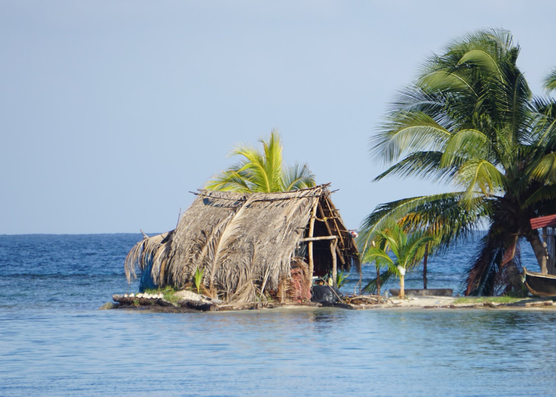
Guna outhouse
We learn that the coconut was once the only currency that the Guna used, and was highly prized for trading with the Columbian boats. Even now each coconut tree is owned by a family and everyone knows whose coconuts are whose. It is important not to help yourself to coconuts, even ones on the ground, as they belong to someone. The Guna are also a very closed society and it is not permitted for outsiders to own property or run businesses here. Their society is matrilineal with women having a significant role in decision making for the community. Marriage outside of the Guna tribes is also not allowed, and could result in ostracism. As a result the relatively small Guna population are all very closely related and albino Gunas are not uncommon. It’s a harsh environment if you have no pigment in your skin, and we did meet one young fellow who scored from us a pair of our sunglasses and a cap for protection. The Guna are also very accepting of transgender people and it is not uncommon for men to dress in women's clothes and wear make up etc. People are allowed to express themselves as they please. We meet one transgender Mola Maker (Mola Lisa) who is very well known in this area and makes beautiful Molas and some funky accessories.
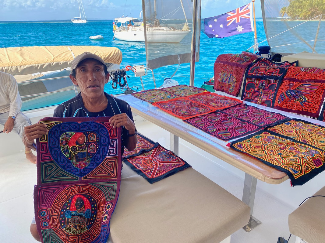
Master Mola maker Venancio displays his wares
My what a lovely Mola
What is a Mola? Mola are the Guna’s fabric handicraft. They are fabric panels about the size of a laptop with multiple layers of colourful fabric sewn together. Patterns are formed by cutting out and stitching, all by hand. There are abstract patterns, which are more traditional ones, as well as animal and birds more popular with tourists. The Guna ladies wear them as part of their traditional costumes, with matching panels added to the back and front of their shirts. The ladies also wear long strings of tiny glass beads wrapped around the full length of their calves. These are not just for special occasions but worn on a daily basis around the house. At our first anchorage at Chichime Cays we get a visit from one of the most famous and persistent master Mola makers, Venancio. He and his offsider politely invite themselves aboard and bring a 15 gallon drum filled with Molas!! Before I know it our cockpit is covered with dozens of brightly covered Molas. They really are quite beautiful and very well made. Some of the more complex ones must take weeks to make and are priced accordingly. Its so hard to choose, but I end up with 4 by a process of elimination. Venancio is a little disappointed and tells me other cruisers by 10 or more! Well at his prices and at our first island I will stick with my 4 and spread the love to other vendors. 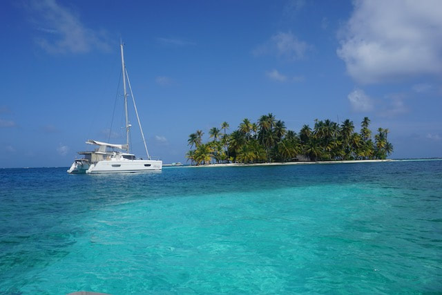
ITIKI at another beautiful anchorage
One morning at Coco Banderras – a word of caution
It can be challenging navigating around these waters. Whilst there is plenty of depth between the island groups or cays, within the cays there are shallows and sandbanks, the odd wreck and coral head. Approaching an anchorage, care is needed and our pilot book is worth its weight in gold. Sometimes it looks like you can make a b-line for an anchorage but end up having to skirt around it, taking the scenic route. It’s always important to have someone on lookout when navigating inside the cays and its best to move around between 10am and 2pm when the sun is over head, giving you good visibility. 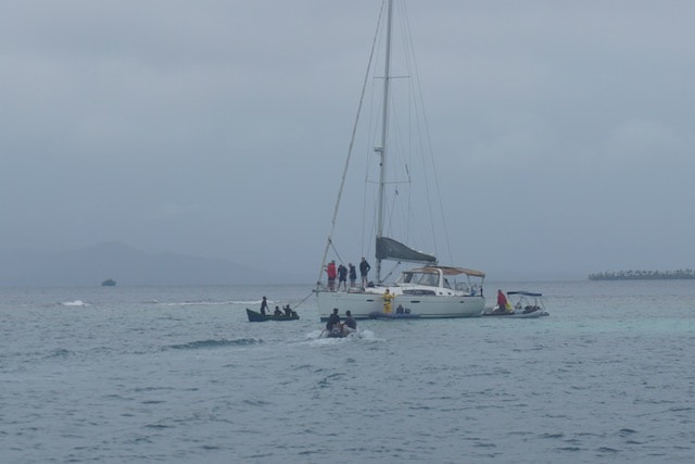
Stuck on the reef
Quite a strong rain squall came through the anchorage in the morning, with heavy rain and wind up to 25kts. A mono left the anchorage in overcast conditions and was passing the end of one of the small islets but stopped suddenly. Clearly he had cut the corner and had running aground on a reef or sand bank. Keith went over to help, getting drenched in the process as another squall came through. The yacht had smashed their propeller and also lost their main anchor trying to kedge off so they were in a lot of trouble. A Guna fishing boat with an outboard motor came to help and after a while more dinghies joined in the effort. Eventually they were freed but had to be towed with off a flotilla to a new part of the anchorage away from everyone. The Guna were able to dive and retrieved their anchor and as well as their prop, which was in 3 pieces. Amazingly one of the other boats in the anchorage, which was the same design, had a spare prop that fitted perfectly – how lucky was that.
Dont you touch those coconuts!
It's always sad to move on but that time inevitably comes. We realise we are very privileged to have visited Guna Yala. With no resorts on the islands and only very basic accommodation on one or two islands, a visit by yacht is really the only way to experience this unique part of the world.
Getting thereWell we are getting to be quite intrepid with our land based exploration since we have been in Columbia. We heard about this trip from fellow cruisers and it just sounded too good to miss. It was getting close to Christmas though and flights and accommodation were tight, but we managed to fit it in. I have to say it was the highlight of our time in Columbia. Columbia has a small slice of the Amazon river to call its own, bordering Brazil on its east and Peru on its west. Our journey will take us by plane via Bogota to the riverside hub town of Leticia before travelling by boat upstream to the small village of Puerto Nariño and then finally taking an even smaller boat further upstream to our beautiful rainforest hotel, Eware Refugio, hosted by Carlos and Zoraida. 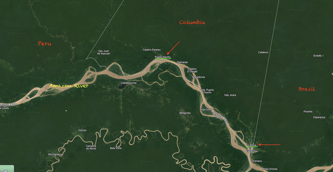 Puerto Narino (centre) and Leticia (bottom right) We are up at 4am to grab a taxi to the Santa Marta airport. After recent reports of nightmarish travel experiences in Australia, with long queues at security and cancellations and angry travellers etc we were delighted to find our flights were on time, planes were modern and clean and despite being so close to Christmas and very busy, everything seemed so much more civilised, passengers calm and well behaved, compared to internal flights in Australia. Our first (aerial) glimpses of the Amazon jungle was impressive, its thick and green as far as the eye can see. Its a very quick taxi ride to our B&B in downtown Leticia, which is a substantial and busy town, although it’s a bit grotty. We arrived here too late to get the last boat up river so we need to stopover for the night. We go in search of the ticket office for tomorrow’s boat trip and we are told we need to be back to check in at 6:15am tomorrow, although the boat doesn’t leave until 7am... Hmmm I wonder why? 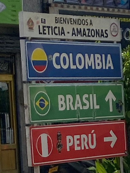 That afternoon we waited out some heavy rain in our room, I guess we shouldn’t be surprised given that we are on the edge of the Amazon rainforest. The rooves have no gutters, they would probably fall off with the weight of water. Once the rain stopped we started walking towards the Brazilian border as there is a viewing tower nearby, but as we got closer and closer, the streets got dodgier and dodgier. It was also getting darker and darker, then suddenly the heavens opened again. We waited under an awning for a bit and when it got a little lighter, ran to the next awning and hopped from shelter to shelter back towards the hotel. Getting soaked couldn’t be avoided though as the streets quickly turned to muddy rivers and pavements suddenly disappeared under torrents of water. Eventually it slowed to a drizzle and we managed to find a chicken shop for some dinner. We heard that gumboots were “de rigeur” in these parts, well I can now see why. 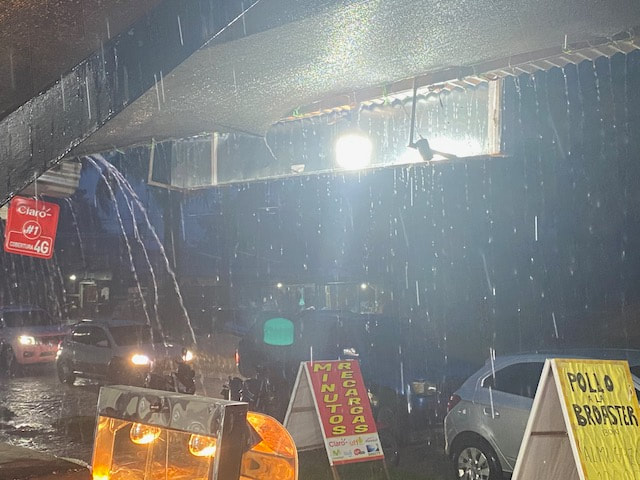 Waiting out the rain After a quick breakfast we did in fact make it to the ticket office about 6:20 and lucky we did not push it until later as we had to follow the gumboot-clad lady with the clipboard and head down to the muddy river, trek across a dodgy wooden bridge to a small island, then traipse along a muddy and water logged pathway, through a small village to get to the Amazon side of this island. Then it was down another muddy slope and across a precarious gangplank to the floating ferry dock. No OHS here! And just like that, we are standing on a floating dock on the edge of The mighty Amazon! Wow. We are some 2000kms from the mouth of the river in Brazil but it is still about a kilometre wide here and flowing at about 2-3kts. 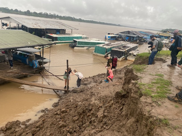 The ferry dock... Boarding was very orderly and once we were all on board a game of bingo was announced. If your seat number was drawn they refund your ticket! Once we got under way it was raining so the opaque, red side covers had to come down and it was like being in a darkroom. Didn’t see much as a result but we made quite a few stops along the way, some of which were just nosing the boat into a mud bank so someone could jump off the front. We also seemed to give a fuel container to another boat that pulled alongside. The journey took about 2.5 hours with all of the stops and we are going against the flow of the river so it will be quicker on the way back. We arrived at Puerto Nariño about 10am and as there was no one from the hotel waiting for us, Keith negotiated with a local boat to take us to our Refugio, which was about 10 mins further up a side stream. 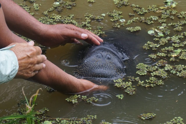 Moache Chris and Laura (SV Zephyr, also in Santa Marta) are already here and have done a few local tours. Laura and I were sitting on the seat by the river and a guy (Luis) came up in a boat with some plants in boxes. Laura got chatting to him in Spanish and I picked up a few words, including manatee. Turns out he is caring for an orphaned manatee (named Moache) in the pond at the back of the Refugio. Moache (means “thank you” in the local language of Tikuna). We watch as Luis gets around the pond in a small dugout and places the plants in floating moats. These are the manatee’s favourite food. He also cleans out some of the weed that Moache doesn’t eat. Moache will be released back into the wild in April. He is pretty big already, weighing in at 200lbs! Luis tickles him under the chin from the shore, wow that is a face only a mother could love (I mean Moache’s, not Luis’!) Luis does get some payment for his work but puts in his time to caring for Moache because he loves doing it. 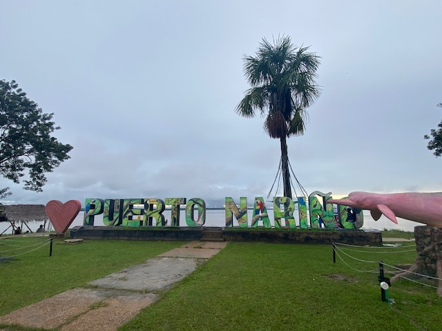 Central Park, Puerto Narino Chris had been bitten by a dog in Puerto Nariño a few days earlier and had to get a series of Rabies shots so needs to go into town in the afternoon. As he does not seem to be foaming at the mouth yet we decide to join them. Puerto Nariño is a reasonable sized town and has some pretty solid stamped concrete paths (follow the red-bricked road) that left us wondering where they got the money! Surely not the Chinese! There are no cars or vehicles here at all, as there are no roads into the town. Everything must come by boat! Tourism is very big business here and very well done. All the guides are qualified and accredited, although few speak English. There are some huge statues of native animals around the streets and also plenty of Christmas decorations, both in the streets and on people’s houses. Apparently there is a competition for the best decorated house and we learn later that the first prize is a (live???) cow! We climb the steps of the “mirador” (viewing tower) which gives an incredible panoramic view over the treetops and along the mighty Amazon river. The clouds over Peru are incredible, long dark roll clouds like you might see over the ocean. Looks like we could be in for more rain! Our BnB hosts are in town doing shopping and we meet them for a lift back to the hotel. As we were heading down to the boat we saw some of the famous pink river dolphins of the Amazon. They are quite a different shape to regular river dolphins, with a longer dorsal fin and a distinct pink underbelly which you can catch a glimpse of as they come out of the water. Very special! We have organised a few tours during our time here and we are looking forward to exploring this unique place.  Hanging nests of Oropendula We are woken very early the next morning with lots of people leaving today - they were up thumping about and talking at the top of their voices. We did get back to sleep after they left though! We had a slow morning pottering around the grounds of our Refugio. The gardens are lovely and lots of native birds, plants and flowers to see. One type of bird, the crested oropendola, builds an elaborate hanging nest, over a meter long, weaving it together with twigs. It must take the weight of their eggs and chicks and be placed out of the reach of tree dwelling animals such as monkeys. There is also a mirador here which gives us a great view into the tree tops and along the river. We drop by to see Moache who comes up to the bank thinking he might be getting fed. He really is quite a big fella!  Ready for action! Having been assigned a set of gumboots for the duration of our visit here, we are now well prepared for exploring! Mid-morning we walk the 45 mins into Puerto Nariño through the jungle, passing some long trails of busy, leaf cutter ants. The smell of the rainforest is really unique. The Christmas decorations are continuing to be built and some are getting very elaborate. We find a local restaurant, have catfish for lunch and sit by the river for a while. Our guide Danny, and translator, Damien meet us at 2pm and take us by boat up to Lago Tarapoto. Spotted some pink dolphins on the way but they are very shy of the boats. I take a quick swim in the lake and the water is lovely. Further on we visit a local village and stop for a beer and a chat to the locals. 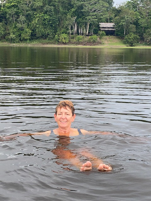 Swimming in pirhana infested waters Heading back along the river bank we stop to see a big tree with amazing root structure, a bit like the ones in Indian river in Dominica. The boys are full of tall tales about huge Anacondas which appear in the river when the level rises. Finally we stop and fish for piraña. Our fishing rods are pretty basic, a stick with a line tied to it, and a hook with a little meat. I can feel them nibbling but nothing bites. Danny catches a small one and then Keith does too. Hang on, this is really close to where I swam! The teeth are pretty sharp but their mouths are tiny and the boys try to convince me that they are scared of swimmers… On the way back we see the most amazing rainbow, almost a triple with another one above it. Sunset is beautiful although not as colourful as over the sea.  Who woke me up?! Next morning we awake to the sound of the birdsong which was lovely, although they are pretty noisy - the roosters can’t compete with the native birds. We meet Damien and Danny again and they take us across the Amazon river to Peru. A short, stocky Peruvian Indian man with a big machete meets us on the muddy shore. We nose the boat in, jump out and scramble up the muddy bank. I am beginning to like these gumboots! We had to write our names in a book but no stamps in the passport, only photos standing by the Peruvian flagpole. Our local Peruvian guide Wilmer took us traipsing through the mud and jungle to look for sloths. In Spanish they are called “lazy bears” (osos perezosos) or “the lazies” for short. Found a few that were too high to see well but eventually found some low ones. They are sleeping of course, like Koala’s they do that for most of the day. Damien woke a couple of them up with the tickle of a stick and we so we could say “hola” get some photos. They were not impressed! Stopped by a small lake with giant lily pads but these are not floating due to low water levels which the locals are not happy about. There hasn’t been as much rain as usual, which means they are not able to get the fish they would normally eat. We enjoyed lunch at a local village, a lovely meal of catfish. Saw a toucan in a tree but he took off before we could get a closer look. On the way back to the boat we stopped by the river’s edge to see where the bank had collapsed very recently. Apparently one house was very close to the edge here and so they have now moved further inland. The river's borders are constantly changing with islands forming and disappearing as well. The family here have a pet capybara and it is munching on some grass nearby the “dock” when we get back, it’s the first time I have ever seen one.  Waiting for high water, hope that house floats! It’s almost the end of the dry season now, but even so the river is lower than it should be. It will rise some 8-10m through the wet season before it starts to fall again. All of the low, dry season docks will be underwater or will get washed away and need to be rebuilt when the water recedes again. They are generally fairly flimsy, well just strong enough to make it through the dry season. The high docks are visible in places like Puerto Nariño and are much more substantial and permanent structures, built to withstand the rains. With no roads into the town the river is the lifeline and transport continues throughout the year. There are a few floating houses as well, which do look a little flimsy, but they must survive the rising waters. As the river falls again this is also a challenging time, as they may come to settle on some large tree and end up with a sloping floor!  Sunset over the high water dock at Eware Refugio Our Refugio is a lovely, peaceful place and after an exciting morning we take some time to chill out by the pool, and spent the rest of the afternoon relaxing in hammocks and watching the sunset. Our final tour before heading back to Santa Marta begins at 8am the next day, with Alvino, who is Danny (our previous guide’s) father. We picked up Damien our translator on the way. It took about 45mins down river to get to Mocagua where we met our local guide. He led us through the village and thick forest, pointing out different plants and trees along the way, to the monkey sanctuary. We pass by a lady doing the laundry in a local stream which makes me thankful for the Bosch front-loader. At the monkey sanctuary we meet an American volunteer who gave us a run down on the place. There are no cages and animals are free to come and go as they please. Food is available for them throughout the day and although the animals do interact with visitors, the park are very insistent they don’t want people posting selfies with monkeys on their heads etc. They basically take in animals that have been kept as pets or orphaned etc and take care of them before releasing them. There are several different kinds of monkeys as well as black tamarins. Animals are released when they reach maturity by taking them to an area known to have tribes of the same species. It’s easier for a new female to be accepted than a male as the males have to compete with the other males and find their place in the hierarchy. We watch the monkeys playing around and I have one jump on me unexpectedly and yelp! Later another climbs onto me but I stay calm and it nicks the top off the insect repellent spray. Cheeky bugger. We could watch them for hours and I take lots of photos. We walk back to the village, have a lovely fish lunch before the long boat trip back to our Refugio.  Monkeying around It has been an amazing and very interesting time here, seeing so such a vastly different environment to anything else we have seen in the Caribbean. The Amazon River is the life-blood of the communities here, a very unique and special place which we have been very fortunate to visit. We are looking forward to coming home to ITIKI though. It’s Christmas eve tomorrow and the hotel will be closing. There is only one other set of guests left here now and as we have an early start and a long day of travel ahead of us, we settle the bill and have an early night. After an early breakfast we are picked up at 6:30am to get the express boat to Leticia. It is a faster trip back as the tide is with us and not quite so many stops. Once we get off the express boat we find another water taxi which bypasses the muddy trek across the island to get us into the port of Leticia. There we run into our host’s son, Carlos Jnr who is in town doing some Christmas shopping - he hails a tuk-tuk for us to get to the airport. As before the process of flying is so smooth and civilised, despite being Christmas eve, full planes and a busy airport. I guess it helps that not everyone has 6 devices to pull out of their bags at security. We get back to the Marina just before 6pm and we have been invited to SV Voodoo for dinner. Its lovely to have such a friendly welcome home.
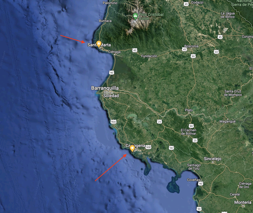
South along the coast from Santa Marta to Cartagena
In our first season on ITIKI in 2018 we spent a few days exploring the coastal Spanish town of Cartagena. Now here we are some 4.5 years on and we are visiting its namesake in Columbia. Who woulda thought!?
Cartagena (pronounced KAR-tə-HAY-nə), or Cartagena de Indias, is one of the major ports on the northern coast of Colombia, bordering the Caribbean sea. Historically it provided an important link to the West Indies critical for world exploration and as a stop on the great commercial maritime routes. Cartagena was a key port for the export of Bolivian silver to Spain, for the import of enslaved Africans and for trade between Spain and its overseas empire, establishing its importance by the early 1540s.
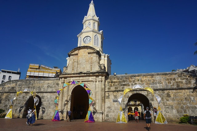
Entrance to the walled city
We had originally planned to visit Cartagena in ITIKI and spend Christmas here, but given the favourable monthly marina rate at Santa Marta, the friends and fellow cruisers who were staying there as well, combined with the challenges of the anchorage at Cartagena, we decided to stay put and do a road trip instead. We opted for an air-conditioned mini-bus, packed our back-packs again and set off, weaving our way up over the hills behind Santa Marta and down again to the adjacent coastal town of high rise resorts. The road travels along the western coast via a narrow spit of land with the ocean on our right and a huge lagoon and wetlands on the left as we head south. These wetlands are host to numerous shanty towns and the main streets are lined with small shops and local food stalls. The town of Baranquilla, at the entrance to the Magdalena River is our next stop and we crawl through traffic in the backstreets for another drop off before finally getting underway again.
Arriving in Cartagena about 2:30pm, we decided to walk to the hotel to stretch our legs. I had a timely reminder that we are not in Kansas anymore, Toto. Almost had my phone snatched out of my hand by a guy on a motorbike as I was Google navigating! Fortunately I had a good grip on it!
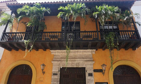
There are many parts to the sprawling city of Cartagena and we base ourselves inside the old, walled part of the town which these days is gentrified, colourful and lively and very European in its style. There are numerous Spanish style plazas and the colonial architecture is well preserved. The streets, many of which are car-free, are lined with colourfully painted homes, shops, restaurants, bars and hotels. 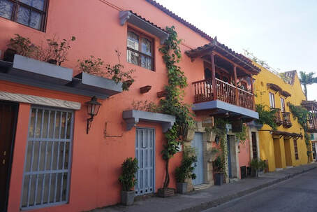
Colourful houses on Cala Hobo
Our Hotel “3 Banderras” on Cala Hobo (!) is an oasis of calm with an internal, leafy courtyard and a rooftop plunge pool. Coincidentally we are three doors down from our friend Shane’s old place. He lived here for 5 years, and has now moved to Panama, where we will eventually catch up - he gave us lots of great tips on where to go and what to see and do. It’s been a long time since we were in such a big, modern city and we spend a lot of time just wandering around, soaking up the vibe, stopping to eat and drink and people watch.
Enjoying the Plazas of Cartagena
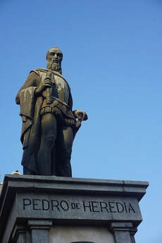
As we often do in a “big” city, we started out visit with a “free walking tour”. These are a great way to get orientated and start to learn a little of the history of the place, from a knowledgeable and passionate local. The walls of the old town run along the western coast facing to the sea, wrap around the south of the town facing the Boca Grande (aka Miami) and the main port which houses the marinas, anchorages, cruise ship and commercial ports. Walls also protect the eastern, inland side of the town. The main entrance to the old town, Clock Tower Square, is where we start our tour. Here we find a Sculpture of Don Pedro de Heredia, Spanish conquistador, explorer, founder of Cartagena de Indias.
 Captivating Bolero Sculpture Captivating Bolero Sculpture
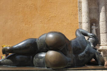
We find Plaza Santa Domingo with its voluptuous Bolero sculpture lounging provocatively outside a cathedral. We dropped into the Inquisition Museum, where hundreds lost their lives thanks to dubious allegations of sorcery. Also pass by the former home of the privateer Sir Frances Drake, which is painted a lovely shade of orange. Along the way we sample some local sweets (hmm), fried street food and drink fresh coconut water from the shell whilst watching some clever street artists at work.
Later in the evening we wandered around looking for dinner and ended up at San Diego square. Throughout dinner we were “treated” to a constant stream of very loud and colourful street performers and buskers who came and went, one after the other. Some of them were actually quite talented but the novelty wore off after the first couple.
Sir Francis Drake's House
Early the next morning we visited the Castle San Felipe de Barajas which lies outside the city walls. We walk along the lagoons and past the impressive statue Monumento India Catalina, the legendary indigenous women who became a translator and intermediary for the Spanish conquerors. Not surprisingly the fort sits up high above the town, its all stone and concrete so it was quite hot. Numerous tunnels run through the fort, which we gladly explore as these are nice and cool. We weave our way to the top for a great view over the city, looking down to the newest part of town, the Boca Grande, with its Miami-esqe skyline, it occupies the peninsula on the western side of the port of Cartagena.
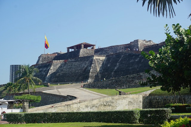
Castle San Felipe de Barajas
The bohemian neighbourhood of Getsemani also lies outside city walls and we enjoyed several visits here at different times of the day. It’s a little less touristy than the walled city, definitely not on the cruise ship itinerary, but fairly lively with lots of street art, galleries and colourful decorations in the car free streets. We find one street decorated with umbrellas hanging and another with flags of all nations. At every turn in the narrow streets and laneways we see colourful street art and murals decorating the walls. Our favourite street art was a painting of the famous Columbian author, Gabriel Garcia Marquez sitting at a table, with the yellow butterflies of his famous character from "100 Years of Solitude", Mauricio Bibliano circling overhead. A small seat strategically placed allows you to join Marquez at the table for a chat.
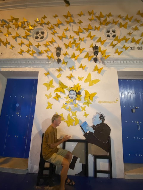
Keith chatting with Gabriel Garcia Marquez
The central square of Getsemani, Plaza de la Trinidad, hosts a church and small square surrounded by bars and street vendors. Ladies dressed up in red, yellow and blue costumes (Columbian national colours) will pose for photos with bowls of fruit on their heads, looking very Carmen Miranda. In between gigs they sit around looking bored, chatting with each other or staring at their phones. I liked those photos better! Of an evening the plaza is buzzing with people out and about, checking out the Christmas decorations around the church. We brave some street food of arepas (a kind of mini burrito) and enjoy watching families and friends socialising until quite late. The Spanish culture of “siesta” has been adopted here so it’s common to see young children out and about quite late with their families, having had a sleep in the middle of the day. As much as we try to fit in, even after an afternoon nap, we still struggle to stay up past 10pm! 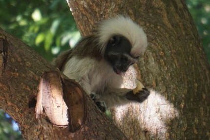 Cotton Topped Tamarin Cotton Topped Tamarin
Parque Centenario, just outside the main entrance to the walled city, was another spot we visited several times. Its huge, leafy trees offer welcome shade and unexpectedly it also houses some interesting wildlife. On our first visit here we spotted a huge iguana and also a cotton-top tamarin (a kind of small monkey). Someone was feeding him a banana and we stopped to watch. He gave some to Keith to feed to the tamarin! as well - magic. He is a little timid (the tamarin that is) but bold enough to come down, grab the banana and run back up to a higher branch to eat it. The next time we drop through we manage to find a sloth. A small walking tour group had spotted it and we heard from the guide that this was a female sloth who had recently lost a baby. I guess that means there is a male sloth around here somewhere too. Somehow, slowly, they have found each other. She was not only awake, she was actually feeding on leaves, munching and moving very slowly. How amazing to see this in the centre of such a big city.
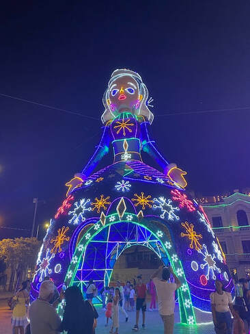 Go big or go home! Christmas decorations in Cartagena Go big or go home! Christmas decorations in Cartagena
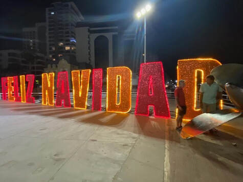
Well it is Christmas time (Feliz Navidad!) and it seems the Columbians love big, gaudy, colourful decorations. If we thought Santa Marta was pretty amazing, the Christmas decorations in Cartagena are really over the top. Inside the city walls one plaza is completely overtaken by a replica of Bethlehem, and biblical scenes but with a decidedly winter theme, with snow, skiers and ice skaters as well as and gingerbread men featuring – just over the top! Just outside the city walls by the port area there are giant Christmas trees and a enormous Barbie doll (Frozen?!). Its selfie heaven! Meanwhile in Getsemani, Santa Claus seems to regularly sneak in to the manger scene as the 4th “wise man”..
On our last day in Cartagena before heading back to Santa Marta, we walked along the ocean shoreline to Boca Grande, which is the Miami of Cartagena. Went to a multi-storied, air conditioned shopping mall that could have been anywhere in the world, but it was a strange novelty to be in such a place after so much time in relatively primitive places. Had coffee at Juan Valdez, which is Columbia’s answer to Starbucks, but with good coffee (according to Keith). It wasn’t long before we found ourselves gravitating back to the Getsemani neighbourhood for lunch and a final visit to this funky neighbourhood.
Sunset on the city walls
As the city cools down in the afternoon the people come out again and so do the street vendors, selling souvenirs, hats, food, clothes and even aphrodisiacs made from bee pollen! A favourite activity in Cartagena is to take an evening stroll along the town walls and bastions facing the sea, and watch the sunset, and we do this each evening. Here we find the famous Café del Mar, with its long queue of wannabes waiting to get in and buy expensive cocktails. We much preferred to buy a $1 Corona from the local vendors and find a spot on the wall to watch the sun set over the water. A lovely way to end a day of sightseeing and to say our fond farewells to this vibrant city!
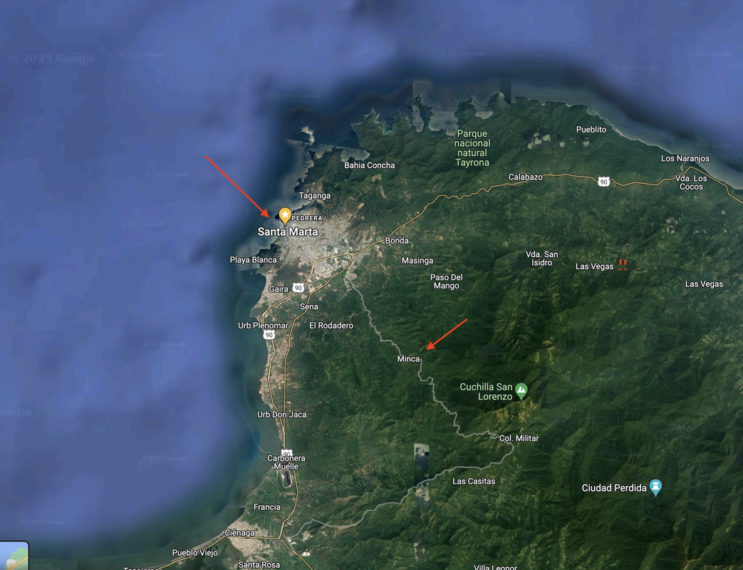 Santa Marta to Minca The tiny village of Minca is a popular side trip from Santa Marta. Its only 40mins by mini bus and gives a taste of the foothills of the Sierra Nevadas de Santa Marta. We pack a couple of small bags and set off to find the bus station, which is in a very busy part of town right near the public markets. Once the bus is full of people, and fully laden it departs - promisingly there is a huge sack of limes on the roof of our vehicle, destined for Mojitos no doubt. The bus trip takes us through the outskirts of Santa Marta, crawling through traffic before we start heading up into the hills. Our AirBnB host Luis meets us at the bus stop and drives us to our accommodation over a pretty rough, narrow and steep road. Accommodation is basic, no hot water in the showers here, actually there is not even a shower head, but we do have towel swans on the beds! It’s a 10 minute walk down to the “CBD” of Minca (ie one street with some lovely bars, restaurants and cafes) a fairly steep footpath to a small but rapidly flowing river which we need to cross via simple, 4-bamboo pole bridge. Don’t look down, don’t look down – phew made it! We become very practiced at this! The small town is a great place to chill out, not much going on at all, which is super nice after the bustle of Santa Marta. 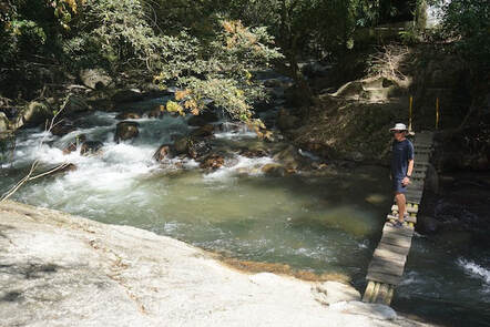 Careful on that bridge! In the afternoon we take a walk up to the Marinka Waterfalls, it’s about an hour, winding our way gently upwards crossing the odd creek and dodging waterlogged muddy patches. There are some huge stands of bamboo along the way (handy for rebuilding the bridge when it floods…) and quite thick forest as well. The waterfall complex is lovely, well developed and there are two areas to swim in as well as some net balconies to chill out on. We take a dip in the lower level and it is truly “refreshing” – ie really bloody cold. After drying out and warming up we walk up to the upper level of the falls. These are more rugged and surrounded by huge boulders. Beautiful! No need for a swim here, just pose for a photo or two before heading back down the hill. 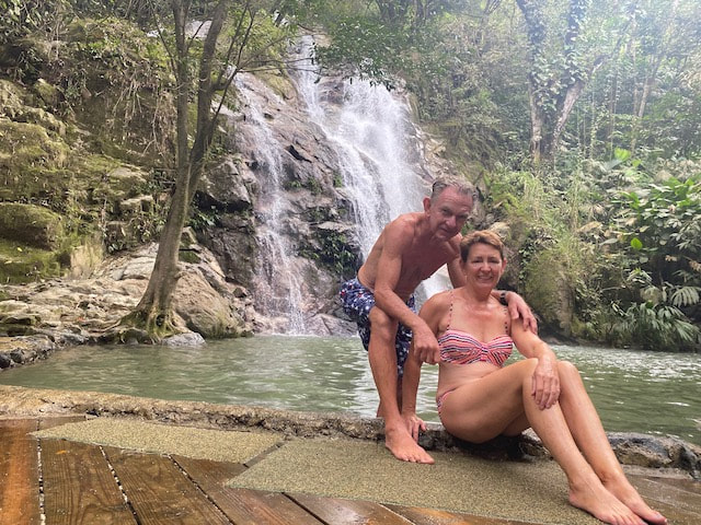 Marinka Falls The next day it’s another walk in the opposite direction, this time to a place called the Pozo Azul. This one is a little closer and as it is accessible by car so it’s popular and very busy. Not as nicely landscaped or maintained though. We paddle up to our ankles knowing how cold the water is and spend some time sitting on the rocks, people watching before walking back for a late lunch in town and an afternoon rest. We head out for cocktails before dinner (with some fresh limes of course!) and found a great steak restaurant for dinner. We are long overdue for a decent steak and Colombia does meat really well! We enjoy our meal under the watchful eyes of a couple of the local dogs, who will no doubt get the leftovers out the back later on.  Bird watching On our final morning we had an early start to do a bird watching tour. They gave us some really good binoculars and I had my camera so I was fully laden. It was about a 4km walk each way up into the hills, and we did see quite a few birds. Keith saw a Toucan in a tree and I saw it later flying. Still haven’t seen one up close though. We ended up at a banana farm that has quite a few bird feeders so got to see a few more species up close, including some hummingbirds. It was a lovely walk up in the hills and we could look down onto the coast and see Santa Marta at sunrise in the distance. All too soon it was time to leave and our host dropped us back at the bus stop for the return trip to the relative chaos of Santa Marta, and of course to ITIKI. We are feeling suitably relaxed and ready for our next side trip, to Cartagena. Aruba to Santa Marta 300nm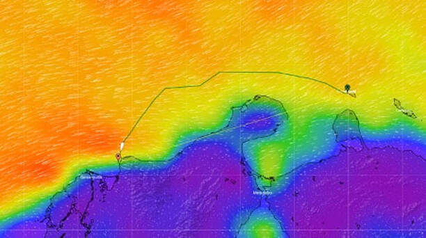
Our planned route from Aruba to Santa Marta, staying out wide
The passage from the ABCs to Columbia is rated as one of the toughest and trickiest in the world for cruisers. The section from Aruba to the Columbia / Venezuela border is still part of “pirate alley”, although it has been a while between reported attacks. The winds around Punta Gallinas are regularly much stronger than forecast and as you come in closer to the Columbian coast there are underwater channels that cause strong currents. The Sierra Nevadas run close to the coast here. The highest peak, Pico de Columbus 5775m, is located only 42km inland. This is the highest coastal mountain in the world. This mountain range – Sierra Nevada de Santa Marta – stops all small systems from the East and attracts its own weather system. The mountains provide a runway for the notorious katabatic winds along this part of the coastline, which generally kick in overnight. The many wrecks along the coast attest to the fact that it can be dangerous going in too close to the shore. We plan to keep well offshore (20-30nm) in very deep water (>1000ft), giving Venezuela a wide berth, sailing this leg conservatively, prepared for the worst. Despite my experience I have to admit I have gotten caught up in all the hype about this passage and my stress levels are mounting! I was less concerned about the notorious Bay of Biscay!
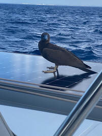 Hitch-hiker Hitch-hiker
We always like to arrive in a new port in in daylight and Santa Marta is no exception. Apparently the katabatics back off in the early morning so this is a good time to be approaching the coast north of Santa Marta. After pottering around in the morning, and watching Australia v Denmark in the World Cup, we upped anchor and motored around to the Aruba customs dock. The garbage pile between the anchorage and the dock is still burning and there is a lot of acrid smoke. Not so nice for the people going to the luxury resort on nearby Renaissance Island! Check-out was easy and we were off before we could change our minds! We set off with one reef in the main and full genoa on a broad reach. We are sailing nicely with good speed, getting 9-10kts, but the sea state is a bit ordinary. We have a short, beam-on chop which is not huge but forward of the wind direction so it’s uncomfortable. We had a hitchhiker for an hour or so, a juvenile boobie took up residence on our solar panels. Sadly he did not leave them clean…
Not much in the way of scenery
The sea state eventually settled as we got further from Aruba, leaving us with a much nicer motion in the ocean, with just the occasional rogue giving us a smack. Late afternoon I was watching a ship on AIS called Dolphin, quite a big one and right in our path. He was not moving much, but sometimes we see ships seemingly drifting at sea “waiting for orders” (it’s cheaper than waiting in a port). As we got closer and closer I expected to see it, but nothing was visible at all, even 2nm away. Very strange. Still nothing at 1nm, maybe it is a submarine? Just then a pod of small black dolphins appeared and started jumping and playing around ITIKI, leaping right out of the water and into the waves. Lovely to see, just on sunset. But what about that ship? Oh wait, maybe some crazy dolphin scientist was having some fun when they programmed the tag on one of these little fellas?! I guess we will never know…
 Staying well offshore Staying well offshore
Made our first waypoint around 11pm on day 2, due north of Punta Gallinas so we could pull away and start to go south a little, but still keeping well offshore. Having goose-winged the genoa we have slowed down, but still making reasonable time. It’s nice to have the waves with us now, although it’s still a bit rolly. We had a beautiful half-moon for a while but once that set it is pitch black. The skies are clear and the stars are absolutely amazing - this is the best part of night watch, and we love being able to see the Southern Cross. There is quite a bit of traffic around this area, and surprising to see one quite large ship without AIS. Fortunately we could track him on RADAR.
After the morning squalls and shipping passed us by we have had a lovely reaching sail down the coast of Columbia. Not that we can see it as we are staying wide to avoid the weird coastal currents and instead have the gentle seas pushing us along. Despite some good long hours of sunshine, passing clouds and shading from sails means our batteries are not quite full enough to run our fridges and freezer overnight. Our hardest working crew member, Ellie the autopilot, is also a very thirsty gal, so if we want to make water too that means using the generator. Sadly our faithful genset is overheating and despite some valiant efforts by the skipper she can’t be sorted underway. Not to worry we have plenty of beer and rum to drink!
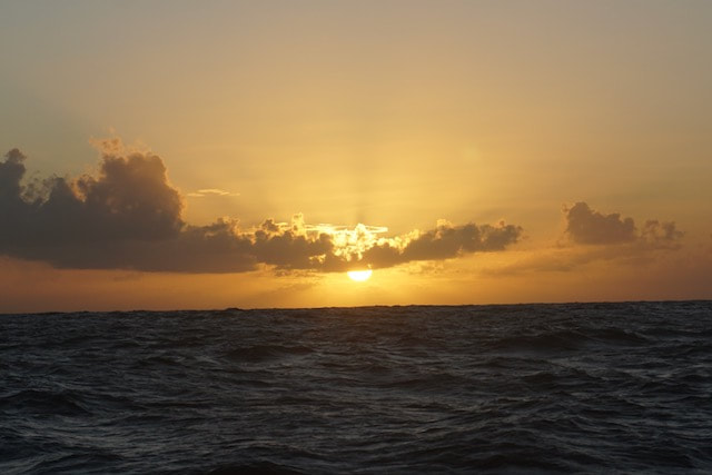
Another boring sunset
Kept our goose-wing through the night and in the morning just after sunrise we got squeezed by squalls on either side that joined forces. A freighter approaching forced us to steer back into one of the squall cells to get out of its way. The windspeed shot up to 28kts very quickly as the front touched us, sphinctometer rating shot up as well! Fortunately it quickly settled into low 20s but the wind clocked south so we were able to gybe the main and come onto a broad reach which is much more comfortable with the swell. We have now set our final waypoints into Santa Marta and arrival is looking good for early Friday morning.
 Approaching Santa Marta Approaching Santa Marta
The wee hours of Friday morning (day 3) find us about 30nm out from Santa Marta. We had quite a lively breeze along this last leg of the journey, with constant wind in the mid-20s. The moon is gone but the loom of light on the horizon shows a definite outline of land. It smells like a pine forest. Our final waypoint was reached at 3am, and we turned due south to come directly into Santa Marta. The angle was not great for the headsail so we furled it and just continued under main. We were still making 6-7kts and it is much easier to handle without worrying about trimming the headsail - no adjustments were necessary for my entire watch. At watch change we decided to put the 3rd reef in the main to slow ITIKI down, and also in anticipation of the katabatics as we come into sight of SM. Copped the first of the katabatic gusts about 10nm out of Marina Santa Marta and although it only clocked showed high 20s we decided to drop the main and finish under motor. By 5:30am there was quite enough light to see the approach to the marina. We went into the fuel dock and waited for someone to appear and the security guard arrived and notified the marina of our arrival. We also bought the cheapest fuel ever! While we were waiting for a berth assignment we watched the shenanigans of a pilot boat trying to come alongside to refuel, I thought they were going to take us out! Total amateurs. We got our berth assignment at around 10:30, its blowing 25-30kts in the marina, thanks to the high mountains surrounding the bay, so getting in was interesting. Keith did an amazing job and the guys on the dock were great too. We sleep for a couple of hours and after lunch head over to the marina office to commence the check in process. Everyone is really nice and helpful and the marina has a good vibe.
Santa Marta
Santa Marta is a coastal holiday town, popular with Columbian families, and of course it is approaching Christmas and the holiday season. Its very busy with tourists, its colourful, lively and noisy.
Gabriel Garcia Marquez
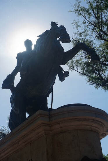 Simon Bolivar Simon Bolivar
As we often do we found a “free” walking tour of Santa Marta and joined in the fun one morning. We learned about some of the history of the town. There is a statue of Gabriel Garcia Marquez here, I was a huge fan of his novels but didn’t know he was Columbian. We also find some yellow butterflies on the street which appear around one of the characters in his famous novel “100 years of solitude”, which I re-read now that we are here. The main Cathedral is set back from the waterfront by about 4 blocks to discourage lazy pirates from having a go and coming to steal the gold. There is a big statue of Simon Bolivar in one of the piazzas. Bolivar is the hero and liberator of these parts having led the countries of Columbia (including Panama), Venezuela, Bolivia, Peru and Equador to their independence from the Spanish empire. His statue is on a horse with its front legs in the air (ie rampant), even though he died of TB and not in battle. There was a big earthquake in 1834 in Santa Marta which destroyed most of the town, so there is little left of colonial architecture. From that time on balconies were made in wood rather than concrete. The country is predominantly Catholic, hence the many churches and cathedrals. The streets are lively and colourful, with street art, street vendors, flags and umbrellas featuring throughout the town. It’s hot during the day and the beaches are popular, at night couples and families promenade along the water front, and there is loud music until the wee hours. We also have the same three Christmas songs (including a Spanish version of Jingle Bells, and Feliz Navidad) on high rotation. It is going to take weeks to get these little ear-worms out of our heads when we leave. The Christmas decorations are out of this world, with the main square replete with a replica of the town of Bethlehem sits comfortably alongside the more "pagan" European scenes with Santa Clause, Christmas trees, and various “winter” scenes through every public square and space around the town. Santa Clause is regularly positioned as the 4th of the ”wise men” overlooking the manger scene, eagerly awaiting the arrival of the baby Jesus. We had a fun Christmas and New Year here with fellow cruisers, with pot luck meals par for the course, progressive drinks/dinners hopping from boat to boat and helping each other out with boat projects, maintenance and repairs.
 Andy and Julie from Cushla, we met in Cape Verde Andy and Julie from Cushla, we met in Cape Verde
Santa Marta was a great base to explore inland of Columbia, as it was a safe and comfortable place to leave ITIKI. It is strange for us to be away from home, sleeping on land but a nice change to visit a big country compared to hopping from islands to very nearby island. Here we also meet and re-connect with old and new friends. The cruisers that are here are generally now on the same journey, heading west, with most of us intending to cruise to Panama, transit the canal and continue on to the Pacific +/- Galapagos. We are on a shared journey and there is an incredible camaraderie that goes above and beyond the usual FaceBook groups. We share the challenges of trying to get deliveries sent to us, get boat work done without getting ripped off, figuring out weather routing to get to the next port, where to check in and where best to provision etc. with tips and information is freely shared. The World Cup soccer is on whilst we are here and there are numerous lively sessions at various venues in this soccer mad country that make it all the more exciting. There are lots of lovely restaurants to explore as well. There are many supermarkets and stores for provisioning for the next stages of our journey. Columbian beer and Chilean wine are popular items to stock up on! We fill every available space on ITIKI but I am still not sure if we have enough chick peas to last until Sydney! The only downsides are the katabatic gusts that rattle the marina berths and the coal dust from the industrial port that coats the boats overnight. Well you can’t have everything. After a month here we are sad but ready to leave and its lovely to know we have an incredibly friendly and supportive group of cruisers networked together as we continue on our journey, crossing paths in various anchorages and sharing knowledge as we continue along the same route – fondly known as The Coconut Milk Run.
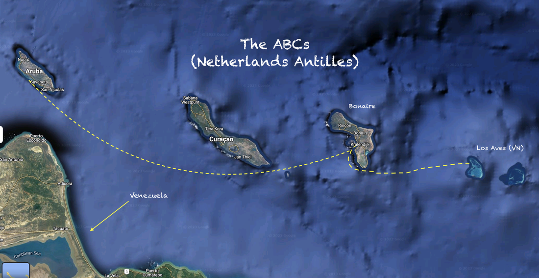
Aruba, Jamaica, oooh I’m gonna take her…
Oh who sings that song and why can’t I get it out of my head?! Well (spoiler alert) he didn't take me to Jamaica but we did travel the 106nm from Bonaire to Aruba. We also decided to skip the “C” of the ABCs (Curacao) as it didn’t read well and we are keen to get on to C for Columbia. It’s an awkward distance, a bit too long for a daytime sail if you want to be sure to arrive before dusk. Aruba's Embarcadero is a tricky port with reefs and shallows and a dodgy customs dock. We opt to do it overnight and arrive in the early morning with good light. Checked out of Bonaire in the morning and said our farewells to fellow cruisers, some of whom we will see again soon! It's been raining on and off all day and it is sad to leave when the weather is grey. We start off with the gennaker and main (1 reef) goose-winged, at times it is light and so choppy that we have the main flogging a bit. Whilst it would have been perfect for the kite, we had to weigh up the effort of taking it down and switching to a 2-sail combination at night as we shifted course around the southern end of Curacao. The breeze was slowly taking us south with this configuration though and at about 11pm, I woke Keith to gybe the headsail, turn away from the fast approaching Venezuelan coast, and come up towards Aruba.
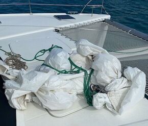 Sail is unscathed but no halyard! Sail is unscathed but no halyard!
We were trucking at first doing 9-10s then the wind backed off and was up and down and shifting direction. We also had a few squalls bringing some rain and a little extra squirt of wind. Keith was on watch around 2am when the gennaker halyard blew with a bang! I had just gotten up and was stuffing my face, so I had to quickly put on my life-vest and spring into action. As had happened before the casing on the halyard shredded in the clutch and so we could not drop the halyard. There was nothing we could do but cut it. It was raining, gusty and dark (these things rarely happen during the daytime!) and there were cruise ships either side of us. We quickly put motors on, came up head to wind to at least try slow down, and blow the sail back onto the boat rather than risk it going under the hull again (it still bears the scars of anti-foul from previous halyard failure). It was easy to cut the halyard with a knife and Keith was able to secure the sail, but we were heading towards a cruise ship. A quick 180 turn to get back on course and then out comes the trusty and bullet proof genoa to first reef. We continued that way through the rest of the night with wind speed up and down and shifting through 30-40o. That was the kind of night time excitement we just don't need! Plus we are now down another expensive halyard!!
Fortunately the rest of the trip was uneventful. Got to the Embarcadera entrance around 7:30am on Sunday morning and dropped sails before heading in and tying up to the customs dock. Check in was easy and the immigration guy came and took a look at the boat and took a picture – no boarding or searching our cupboards though! Customs was similar, we had done our SailClear online before arriving. A guy came on board and took a look in one lazarette, asked about spear guns and then got off. From there we motored along the narrow channel, past the burning garbage dump (not mentioned in the song), the small marina and the airport runway and anchored at Surfside Beach. We have a cuppa and then crash, but not in our bed because the back window was left open and and the mattress and underneath was wet from a rain-squall!
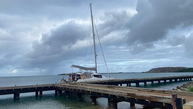
Check in dock
The next day we went into town to have a look around. It’s a bit of an odd place and even with a huge cruise ship in town it’s not that busy. There are lots of designer shops and fake-ish looking colourful houses. It’s a bit of a Legoland! We go to the chandlery (of course) and also buy some shoes. We wander around for a bit, following the tram track through town, (no sign of any tram though) then it starts to rain so we stop for a drink at a bar and watch a bit of football. Back at the ITIKI the crew of OZZ come by. Erika, Kevin and one of their 6 (!) daughters, Mary. Aussies who have been cruising for 40 years with several different boats and have no end of stories! Keith’s shoulder surgeon phoned for a follow up whilst we were chatting. I suspect it was the first time he had a follow up call with a patient sitting on a boat in Aruba!
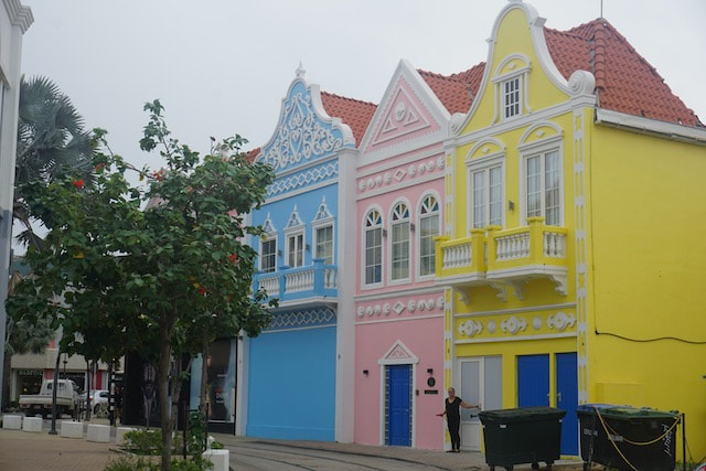
Legoland
We have decided to depart tomorrow so a few small jobs to do in the morning and then we head ashore for lunch. We were both craving steak and the meal did not disappoint! We had to come back to the boat totally stuffed and ready for a nap! Popped over to OZZ for drinks, but did not stay too long as we were too full and still have some prep to do for tomorrow’s departure.
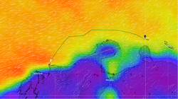 Aruba to Santa Marta, Columbia; 303nm Aruba to Santa Marta, Columbia; 303nm
The next leg of our journey, from Aruba to Santa Marta, Columbia, has a reputation for being a treacherous one. Very tricky with nasty and often very strong katabatic winds off the Sierra Nevadas, as well as big swell and strong currents running around the coastline. Pirate attacks are not unknown in this area, especially closer to the Venezuelan coast. I seem to have gotten myself caught up in all the hype about this leg and am really dreading this one. I file the float plan with some trepidation…
Bon times in Bonaire
The so-called ABC islands are the physical group of Aruba, Bonaire and Curaçao, the three westernmost islands of the Leeward Antilles in the Caribbean Sea. These have a shared political history and a status of Dutch underlying ownership, since the Anglo-Dutch Treaty of 1814 ceded them back to the Netherlands from 1815. They are a short distance north of the Venezuelan mainland and surrounded by Venezuelan waters. Aruba and Curaçao are autonomous, self-governing constituent countries of the Kingdom of the Netherlands, while Bonaire is a special municipality of the Netherlands.
The ABCs
Back in the day the Dutch were a great nation of explorers and seafarers, “discovering” and colonising countries on many continents including parts of Africa, South America and South East Asia. Indeed, Australia was once called “New Holland”, and Tasmania is named after Abel Tasman, the Dutch explorer. Nowadays the Caribbean islands of Aruba, Bonaire, Curacao – the ABCs – along with Saba, Sint Eustatius and Sint Maarten, are part of the Kingdom of the Netherlands. Hopefully that will you will be able to use this information in Pub Trivia!
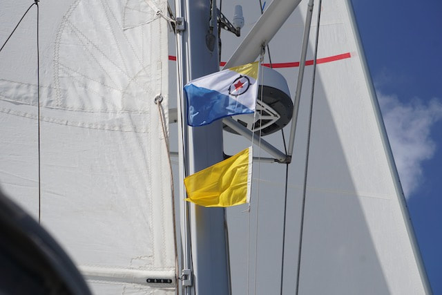
Flags ready for arrival
After an uncomfortable week in Venezualan waters, half anticipating another boarding or even a pirate attack, it was a relief to lift the anchor and cross the 45nm distance to Bonaire. We were keen to spend some time in a country where the rules are clear and unlikely to change at a minutes notice. Hoisted the main with one reef and goose-winged the genoa, making good speed and the crossing was uneventful. Turned on our AIS about halfway across, having had it off in Los Roques and Los Aves – which did nothing to stop the officials finding us.
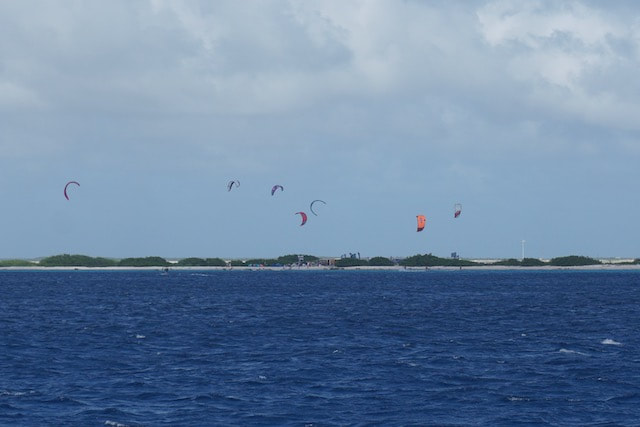
Kite Surfers on the southern tip of Bonaire
Bonaire is quite low and difficult to spot from a distance. As we came to the southern tip of the island we harden up, and see the tell-tale spectacle of kite surfers, which is a sure sign of a compression zone – strong winds and flat water. We get a kick along from that breeze. There is a solar salt farm on the southern end of the island and we can see huge white peaks of salt reminiscent of icebergs. Will we see flamingos here??!
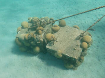 Our mooring block Our mooring block
Anchoring is not allowed in Bonaire as it’s a marine park. We find a buoy in the front row, closest to the town wall. In fact its two buoys with 2 lines off either side of the same mooring block. That is the first time we have seen this configuration, we attach one to each hull. We check in at the Port Authority, it takes less than 30 mins and there is no charge (official or otherwise, that comes later...) and English is well spoken. We get internet for the first time in over a week - great to catch up on our junk mail!
Our mooring buoy is in a wide bay facing, and very close to, the town pier. There is a narrow shelf before it drops off into very deep water. There are lots of people promenading along the waterfront so after morning activities we decide to join them, so lovely to stretch our legs and look around the small town of Kralendijk. In the afternoon I go for a snorkel in front of the boat to check out our mooring block. The water is incredibly clear despite being right in front of the town quay and am blown away by the sea life. There is better coral on our mooring block than we saw at Los Roques. I saw a sea snake, an octopus and an eagle ray. Wow!
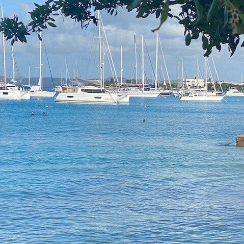
Some fellow cruisers (Laura and Chris from Zephyr) drop by and welcome us, they have been here for quite a while enjoying the diving etc. Bonaire is a popular place to spend hurricane season as it is out of the zone, but still subject to “reversals” which see heavy rain and strong storm surge from the south. During these events everyone leaves the mooring fields and rafts up in the marina. It’s a very social place for cruisers although most of those who stayed for the season have now moved on. We are only passing through but we are fortunate to meet and socialise with several lovely couples and families who are heading in the same direction as us. We are (mostly) all heading towards Columbia, Panama, through the canal and on to the Pacific. It’s great to connect and share information and know that we will be able to keep in touch, catch up along the way and help each other out.
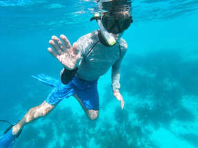 Underwater fun Underwater fun
We spend our time in Bonaire checking out the various snorkelling spots along the coast. There are dozens along the coast north of the mooring field, with many within easy dinghy reach. They are marked with yellow sticks, a bit like the YA markers in Sydney harbour, and each spot is named. There are a lot of colourful fish around the dead coral closer to shore before it drops off to a steep wall, which is the domain of scuba divers. We also see plenty of turtles and large tarpon as well. There is a spot called “Something special” which is just outside the marina. It wasn’t that special but ok. Popped over to the pier near Sand Dollar resort and same found the same sort of thing.
Further along the coast we find Andrea I & II and stop there. There is a steep drop off and we see divers passing below us. The coral is quite good here and a little more colour but it’s too deep for snorkelling. Closer to shore the coral is dead but quite a lot more fish grazing. I also follow a turtle for quite a while. To the west of us there is a small sandy island called Klein Bonaire (little Bonaire). The Beach is popular with day day trippers and we tie the dinghy off to a buoy as someone leaves. Again there is a steep drop off and some quite big and colourful fish. We swim to shore and take a short walk along the beach before swimming back to the dinghy. 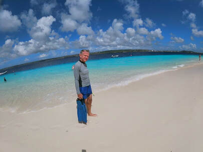
Beach at Klein Bonaire
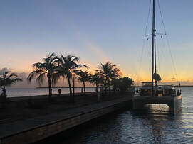 Marina sunset Marina sunset
There are some good restaurants here and we enjoy a few nights eating out, which is a welcome change for the on board chef. We also have a few pub sessions watching the lead up games to the World Cup, including Australia vs France (1-4 to France). Haircuts and provisioning also feature in our land-based activities. It was fantastic to be invited to a soiree on Voodoo for a traditional American Thanksgiving! What a lovely evening eating the most amazing gourmet feast, including some incredible desserts. Of course we had one or two wines as well and chatted late into the evening. Fortunately we made it back to ITIKI without too much trouble…
Bonaire Road Trip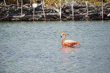 Flamingo in Ghot Meer Flamingo in Ghot Meer
We hired a car for the day to see the rest of the island and do a final provisioning run. Headed north along the coast. The roads are narrow and not in the best condition after the rainy season. Along the way we pass some of the dive spots that are accessible by land as well. We leave the coast come over the crest of the hill for a great view of Ghot Meer (which I think means big lake) and drive alongside it for a while before finally spotting some flamingos! We stop for photos. Result! It’s apparently a saltwater lake, not sure how that works... Further on we have to drive across a flooded section and again stop for photos of the rocks with warning messages on them. We stop briefly at Dos Pos where there is a windmill and the start of some walking trails, but it’s been wet and they are closed. Then we head down to Rincon which is the other large town of the island. Not much happening here so we head up to the national park. This is also closed due to rain but we can check out the museum and outdoor exhibits. These show the early industries on the island like Aloe and lime extraction.
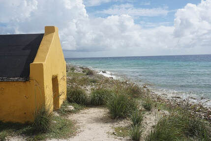
Slave hut: "... and you will get a nice condo overlooking the ocean..."
Grabbed some lunch at a double decker bus on the headland near the airport before heading across to the lake and down around the southern end of the island, where there is a huge solar salt farm. We seem to be the only ones driving anti-clockwise around the point and there is a steady stream of golf buggies and buses coming the opposite way. Hmm, I am sure I didn’t see a “One Way” sign… We saw the lighthouse that welcomed us on arrival as well as the tiny slave huts along the water front before heading back into town.
My kingdom for an egg
Wherever we have been so far, no matter how small or primitive a place, we have always
been able to get eggs. There are regularly chickens running around the streets even. But here in the Dutch island of Bonaire it is somehow very difficult. You can’t just walk into an shop or supermarket and see a shelf full of eggs. Today the big supermarkets have nothing, and tell us to come back between 3 and 4?! After we drop the car back the guy takes us via couple of convenience stores he knows and as it is just after 3:30 we finally find some eggs on the third stop. We make one more supermarket before heading back to the boat and I get chatting to an English couple are looking for eggs…. So what’s the story? Well it seems that there used to be frequent boat traffic between nearby Venezuela and Bonaire, with fresh produce and eggs being imported from close by. But when US/Venezuelan relations soured, US allies including the Dutch were expected to severe ties as well. Not much of an impact in Amsterdam I imagine but the effects locally have been significant. All produce now has to be imported from further afield, at much greater expense, and carbon footprint, and local egg production is struggling to ramp up! Off to Aruba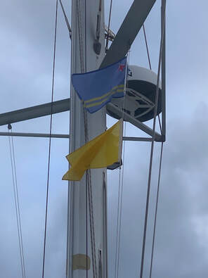 Aruba flag Aruba flag
Well all good things must come to an end so it is time to leave Bonaire, bypass Curacao and head 106nm westward to Aruba. Its an awkward distance, a bit too long for a day sail, and so we decide to do it overnight. Checked-out in the morning and said our farewells to a few fellow cruisers, some of whom we will see again soon! Its been raining on and off all day and it is sad to leave when the weather is dreary. Little did we know what excitement was in store for us on this short passage. You will have to wait for the next instalment to find out what happened on the way to Aruba!
Meanwhile check out some scenes from Bonaire!
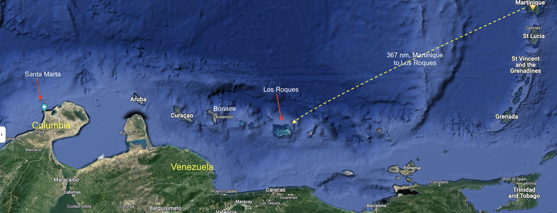 Los Roques is part of Venezuela Los Roques National Park is a Venezuelan archipelago around 160 kilometers north of the capital Caracas in the Caribbean Sea. The protected area contains more than 300 islands and cays surrounding a 400-sq.-km lagoon. The coral reef makes it popular with snorkelers and divers and it is renowned for its isolated, white-sand beaches, kite and windsurfing, fishing and sailing. Los Roques has an atoll structure, more typical of the Pacific Ocean, with two external coral barriers, which protect the archipelago from strong currents. It also has an internal lagoon with shallow waters and sandy bottoms. The islands and cays range from a considerable area, such as Cayo Grande, with an area of 15.1km², to Gran Roque, which despite being the most populated, only has an area of 1.7km². Well that's what it said in the brochures and it sounded like a really unique and interesting place. A friend of ours had passed through several weeks before, giving it glowing reviews, so we decided to see for ourselves. We set out planning to stay around 10-12 days (the maximum allowed was 15 days, or so we thought…) also expecting to visit Los Aves, two smaller and even more remote archipelagos to the west of Los Roques, on the way to Bonaire.  Los Roques has an atoll structure, with fringing reef protecting the east Getting to Los RoquesIt's a 367nm journey from St Anne, Martinique, with steady 15-20kts trade winds from behind, so we left early Wednesday morning. It was such a relief to hoist the freshly repaired Parasailor and to see it looking just like new! Well the bottom half is new and very much whiter than the top bit, which may contain traces of Saharan dust. The sailmaker has done an excellent job. Initially we were looking glamorous doing 8.5-9kts VMG in 18kts TWS, despite the choppy seas. We slowed as we got further from the land and the breeze became flukey, before filling in a gain. A nice way to celebrate my birthday. We carried the Parasailor throughout the night, keeping a watchful eye out for squalls lurking in the dense clouds that have followed us. Made good progress overnight in 10-15 kts and settled seas - just perfect. About 10am we found ourselves with an ugly looking squall approaching us from behind, and a massive tanker approaching us from ahead. Played it safe and took the kite down, stuck the motors on and got out of the way of both of them. The squall passed by with a little bit of rain and a few squirts of wind and it wasn't long before we could sail back on to our course. We have switched from 3 to 4 hour watches on a trial basis. Three hours is just not enough if you spend part of your off watch time cooking, doing weather downloads, changing sails or babysitting a nervous first mate. It’s great to wake up and realise you still have another 2 hours to go! 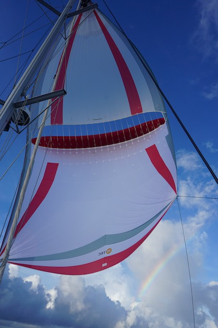 Somewhere, over the rainbow, Parasailor flies.... We made good time on day 3 (Friday), with a few squalls giving us a kick along every now and then. It’s been testing managing the boat through the ones that have come a bit close! The Parasailor has really had a work out and handled the conditions very well. I was watching a nasty looking long cloud system behind us and came up as high as I could hoping to go in front of it. It seemed to just sit in the same place for a long time, and then finally the tail end of it passed over us. Got a little rain as well as some gusts up to 26kts. I was able to pull away and manage the kite without problems. Love this sail! Conditions cleared later in the morning and finally we are getting some sunshine. 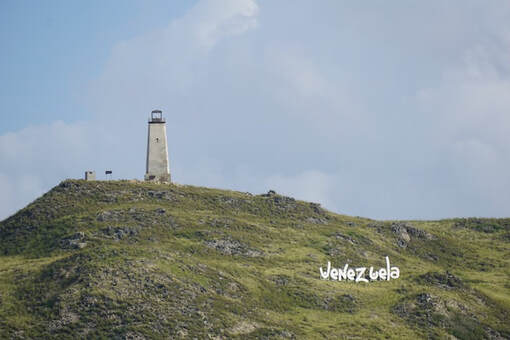 What a welcome!Arrived into Gran Roque on Friday at around 2:45pm and quickly got ready to go ashore, thinking we could check in and then go to a nicer anchorage. Although the check in process is a bit of a multi-step ordeal we decided to have a go at it ourselves, without using an agent. We tied the dinghy to a floating plastic dock between the Coast Guard and the Port Authority. First stop: Port Authority office (a container on blocks to the east of the dock). Here we paid US$60 to start the paperwork fest, and were told in no uncertain terms that the stay in Los Roques was now limited to 5 days, full stop. Literally “cinquo dias y vamos!” Well that is a bummer and not quite the welcome we expected! The Port Captain spoke no English so we used Google translate, then he got Alejandro (the "agent") on the phone who told us that the limit was put in place a week ago! He suggested we should make the most of the eastern anchorages and then come back for our exit stamp in 5 days and then slowly make our way west, as no one will chase us. Hmmm... Next we are taken to the health office, a small Igloo where we find out that we were supposed to have a Covid test before leaving Martinique. Dang! After an interesting discussion via Google translate it seems that we can get stamped in with a "discretionary review" ... I think I will just leave that one there... Then off to the GuardaCostos where the gentleman does speak some English, is very welcoming and says we should contact the GuardaCostos if we need any help. Here we did not have to pay any money. Phew. 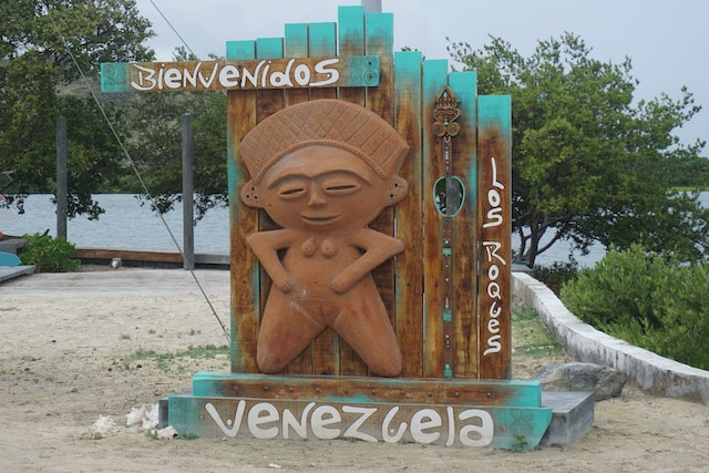 Next stop Immigration, who are at the airport, only to find that we should have first been to the SATIM (national park) office in town, even though they have an office next door to Immigration. Never mind, the Immigration official took us to the SATIM office, which was in the town square in a courtyard next to the bank with the ATM that doesn’t work. Here we got to pay US$30 per person in park fees plus US$57 for the boat. Officially they can now only charge us for 5 days park fees, but the per-person entry fees remain the same. We have a little pennant to display, that will probably last 5 mins in the trade winds. I asked the guy in the SATIM office, via Google translate, where to buy a VN flag. It seems he thought I wanted a pharmacy, so he took me to one. Anyway it was a pretty funny when we realised. Then he took us back to immigration at the airport, and walked into the empty SATIM office next door to Immigration. So more Google translation established that we needed to pay US$180 by card (so we get a receipt!?). That’s for immigration and entry. Then its another US$30 cash per person for our entry stamps (that’s some expensive ink!) We need to come back in 5 days to pay another US$30 per person for our exit stamps. Hmmm… The immigration officers then told us they want to come and inspect our boat. Fair enough I guess, but they dont have a dinghy so we have to take them in ours. Okay… They don’t want to walk all the way to the GuardaCostos where we left the dinghy so we must walk back, get the dinghy then come back to the airport dock and pick them up. When we get back to the dinghy it is absolutely covered in bird$h1t! Every seagull in Los Roques has had a go! I frantically try to wipe some of it off as we head over to pick up the two immigration dudes in their hobnail boots and blue camouflage suits. They are clearly not boaties, judging by the way they got on and off the dinghy and tried to tie up the painter. The inspection seemed a bit more like an outing to see a new(ish) boat, with our starry-eyed guests commenting (GoogleTranslate) on how nice it is and how Keith reminds them of their grandfather. Grandad kept a close eye on them as the younger chap took photos and selfies downstairs, opened a few cupboards and poked around. Not sure if they think people bring drugs into Venezuela... Then they asked for a glass of water and were sort of hanging around uncomfortably. Keith asked why they wanted to see the boat. After a lot of typing they said something about verification. Finally they politely asked to be taken back to the shore, which was a relief. They offered their assistance should we need it. By now sadly it was too late to move and we were sooo tired and out of sorts about our shortened stay. We had a cocktail for dinner and a very early night. 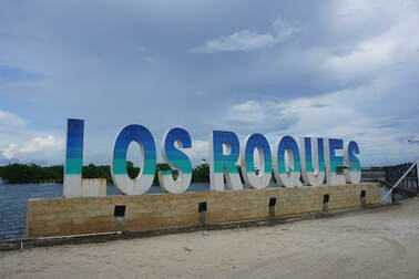 Los Roques Clock Starts tickingDay 1 (or is it day 2?) After breakfast we up anchor and head over to Francisqui island. It’s a horse-shoe shaped bay and we go inside and anchor off the end of the beach. It’s a popular spot with rich Venezuelans flying in from the mainland for the weekend to sit on the beach, drink cocktails and wallow in the crystal clear water. We certainly saw a lot of planes coming in. I take a paddle board ashore and walk around. There is a swamp here and mosquitos love it. On return I find that all the fins have fallen off my paddle board so the trip back involves a lot of zig zagging. We have lunch and then go for a bimble in the dinghy. There are a couple of wrecked yachts in the bay and they have been stripped of all their deck fittings. After lunch we go across to Madrisqui Island and anchor off the beach. The depth is 2m but somehow we find a 4.6m hole and drop the anchor in that. Its a beautiful white sand beach which is popular but not that busy or noisy and we are a fair way from the shore. We relax and enjoy the dulcet tones of a Spanish crooner coming from a nearby power boat... until the owner starts singing along at the top of his voice! 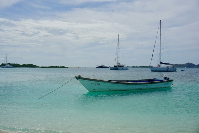 Anchored off the beach at Franchesky 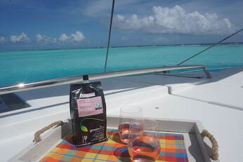 A unique location, deserves a unique Greenskin Wine A unique location, deserves a unique Greenskin Wine Day 2: Sebastapol/Half Moon Reef In the morning, as soon as the sun is high enough to see the bombies, we move to the south east corner of the Archipelago, near Sebastopol, anchoring just off Half Moon reef. OMG! What a place! It feels like we are anchored in the middle of the ocean. All we can see to the east of us is the sea, with waves breaking over the barrier reef 200m away! There's a very shallow sand shelf between us and the reef and we nose the boat in close, trying to drop the anchor on the shelf, but the set-back anchor made it too difficult and it ended up on the slope. Its well dug in to the sand though. The water is chest deep on the sand bank and it’s quite strange standing so close to the anchor. We get afternoon rain-squalls and the mosquitos are pretty fierce so we hang out indoors in the afternoon & evening. Day 3: Soyoqui In the morning the sun came out so dingh-ied to the reef for a snorkel. The coral here is mostly dead except for some huge brain coral bombies. There is an amazing variety of quite big and colourful fish. Sadly there is so much rubbish floating in the water - Styrofoam and plastic - when we are so remote you have to wonder where it comes from. Later in the day a small group of kite-surfers go charging past us, travelling from the north end of the islands all the way down to the south. A quick and exciting trip I imagine. After lunch we moved directly north to an anchorage called Soyoqui, which is a small island with a beach. Took 3 goes to get the anchor to bite in the hard substrate. Initially we thought there were fishing buoys in the bay but it turned out to be just a lot of plastic bottles & buckets etc. More Styrofoam pieces and plastic float past us, very disappointing. I went for a snorkel but it is mainly weed here. On the beach I started to pick up rubbish, there always seem to be single shoes, including the plastic remnants of what was once a platform shoe. The mosquitos moved in rapidly though and I could not get back into the water quickly enough. Day 4: Crasqui North Conscious of our 5 day limited we head around to Crasqui Island. While the charts here are accurate for the reefs you also have to keep your eyes peeled for shifting sands as the depth can change quickly. We picked the gap between two islands and motored around a shallow sand bank to anchor in the north of the bay, which has a beautiful white sand beach. Some fishermen came by to try and sell us fish and lobster but we declined - the lobster was massive and I don’t have a pot big enough! Quite windy overnight but great holding and (bonus!) - no mosquitos! 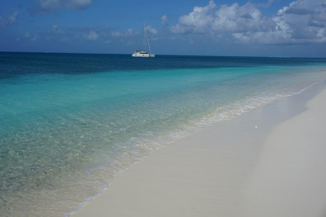 The beach at Crasqui Day 5: Crasqui North to Carenero In the morning we went ashore and walked along the beach which was lovely. The sand is so soft and white quite like Whitehaven in the Whitsunday's. On the north end of the island there is a lot of pumice rock and people have built rock cairns. After lunch we took the dinghy across to the snorkelling area. Could not get the anchor to hold so beached it further south. Managed to swim out through a gap and find the nice area to snorkel. Not that impressive, a few fish and large bombies of brain coral. Couldn’t find the gap to get back in so walked around the point picking our way through piles of Lambi shells. On the way back we stopped by a Lagoon 450 owned by a German guy. He had paid US$3,000 to the agent to check in as he wanted to stay for 4 weeks. He was not happy. It seems the 5 day limit has created some opportunities... Later we moved across to Carenero, a horseshoe shaped bay surrounded by mangroves. Keith puts the drone up and from above it really looks spectacular. At boat level, it’s nice enough and well protected, but as dusk falls the mosquitos move in. It’s very quiet though. 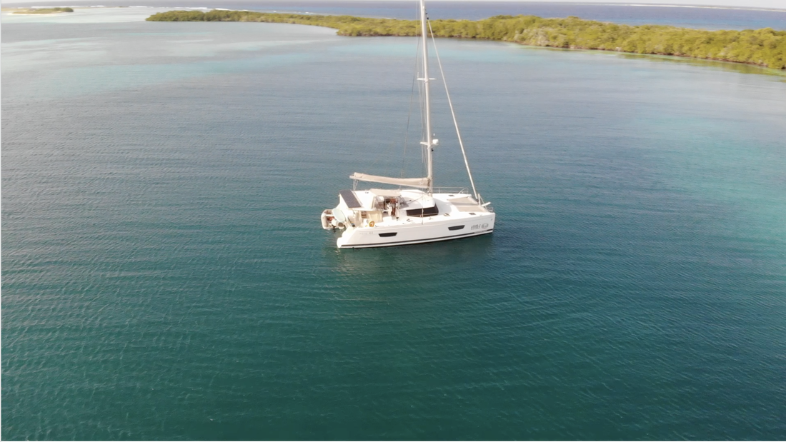 Day 6: Carenero to Los Aves, Barlovento We decided to continue west rather than go back to windward to Gran Roque to pay another US$60 for exit stamps. Our next destination won't care if they are missing. Los Aves, Barlovento is 36nm west of Los Roques. We got away just after 8 and put the kite up in 18kts. Quite a reasonable swell running. Gybed the kite once and then dropped it just as we arrived off the southern tip of the island. The anchorage is deserted but we can see lots of birds nesting in the trees. I thought I saw a boat coming towards us but it turned out to be some waves breaking over a reef in the distance. Have to say we are feeling a little on edge, having not checked out of Los Roques and being over our 5 day limit. We explored the mangroves in the dinghy. There is quite an extensive branched channel and so many nesting boobies in the trees. Amazing! Some are white with bluish beaks and orange feet and others have darker coloured bodies. Male and female or maybe adult and juvenile. There was one wayward pelican nesting in the trees with them. We have also seen some frigate birds flying around here but not sure where they are nesting. No flamingos yet, although apparently there are some here and surprisingly no mosquitos. 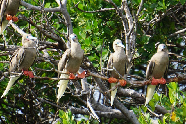 Boobies on a branch Day 7: Los Aves Barlovento to Los Aves Long Island Sotovento 12 nm As we were eating breakfast we were approached by the coastguard boat that came screaming around the bottom end of the island and into the anchorage. Heaps of guys on board including the guy we met at check in, who spoke some English. Him and another guy got on board with their guns. At least they took off their shoes. The English speaking guy did an inspection, first looking in the engine bays and then down below, opening a lot of the floor board covers into the bilges, taking photos etc. All very nice. The other guy dropped his gun on the floor inside and took a chunk out of the laminate. Thank god it didn’t go off! We would probably still be in Venezuela trying to explain it. They asked us if we checked out of Los Roques and we said we had. Looked at our paperwork, which clearly showed we didn’t but he didn’t say anything. They said they plan to go to the other island of Los Aves and they are patrolling because the local coast guard has a problem with their boat. Seems like they will stay the night at Los Aves on the boat and there were a couple of plastic wrapped mattresses on board. All of the guys who stayed on the boat had scarves wrapped around their faces. Keith had his picture taken with the two guys that came on board and it was smiles all round, but still didn't feel like a warm welcome. 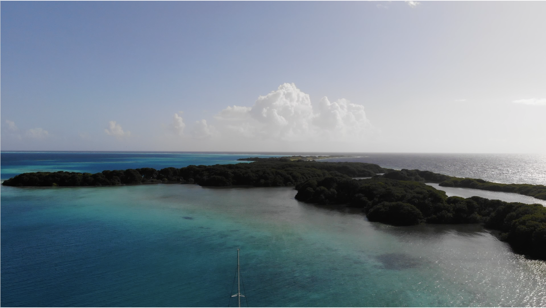 Aerial view of Barlovento
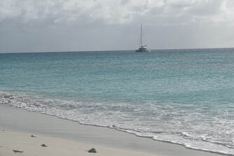 The other 2 and the dog stayed on the boat and we anchored at Long Island. As I worked through the paperwork with one of the CG boys, Keith got some water for the dog. There was a heap of questions and it was slow going with Google translate. Nearly freaked out when my passport was not with the boat papers but it turned up in my handbag! Phew! Then one more guy got on board but his shoes were really dirty so Keith hosed his feet down. The guy in the CG boat came up to the bow, stumbled and fell in the boat. He then blamed the dog and pushed the dog and the dog fell overboard. Anyway there is no way they could get the dog back on the boat with its high freeboard so the dog came onto the back of ITIKI and then they got him back onto their boat. Then two guys did a very thorough inspection, opening cupboards, pulling stuff out, taking selfies etc. Didn’t check the bilges or the engines like the first guy did. Finally the paperwork was done and they politely left the boat, giving us a copy and thanking us. Keith gave them some cold beers. It’s not as protected here as the other bay and we don’t feel like doing much after all the stress of the day, with two inspections! We did however go for a walk along the beach. Not much to see other than the usual collection of rubbish and a few shells. There are some fisherman shacks on the beach and a few people staying in them. Day 8: Out the gate! Left quite early in the morning and given our state of mind it was a relief to lift the anchor. It had been a windy night and we had not slept well. The low island gave little protection from the wind but was good for the swell. It felt good to be heading to a new country where the rules are clear. Did we enjoy our time in Los Roques? Well yes.... and no. It is a really beautiful and unique place for sure, but our experience was tainted by our interactions with officialdom. Being told on arrival that you could only stay for 5 days was a bit of a shock, as the hefty cost of checking in is effectively spread over a much shorter period. Yes we could risk it and overstay, but who wants to run foul of officials carrying guns. Being boarded and inspected 3 times by armed men, who went over the boat with a fine tooth-comb, was also pretty nerve wracking. While they didn't find anything we never felt comfortable that we really knew what they were looking for... In the back our minds too was our proximity to the Venezuelan mainland, we were within easy reach and somewhat vulnerable in remote locations. We were very happy to see the coast of Bonaire.
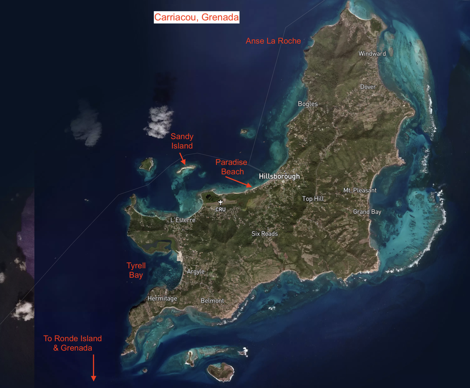
The main reason to come to Carriacou, Grenada was to haul out ITIKI and leave her safe and sound for hurricane season. We are essentially “self-insured” for named storms as our insurance does not cover us for any damage from a “named storm” (that’s a tropical storm or hurricane with a name) in any location, "not now, not ever" (sorry to misquote you Julia)… So the aim was to minimise the risk to the boat by heading to the far south of hurricane alley and finding a location that was well protected and a boatyard that could tie us to the ground with as few as possible potential projectiles around. Tyrell Bay, Carriacou fitted the bill nicely. Protected by hills on one side and mangroves on the other. Mangroves provide natural protection from hurricanes and storm surge and we did a tour in the dinghy to see a number of boats tied up there for the winter. Another plus is that the boatyard keeps all the catamarans together ie there are no monohulls nearby which could fall over onto us! This is indeed a lower risk yard. But the island itself has more to offer than just the facilities and although we spent quite a bit of time in Tyrell Bay, both at anchor and out of the water, we found some lovely anchorages around Carriacou that we enjoyed spending time at.
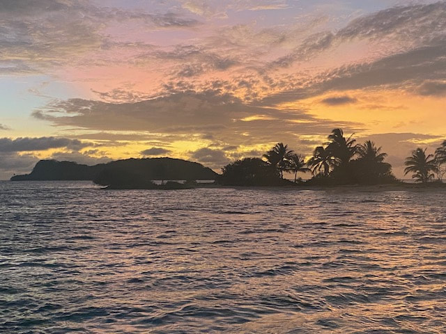
Sandy Island Sunset
Sandy Island
Just 3nm north of Tyrell Bay, out around an unnamed rock which is somehow “snow-capped”, is the lovely and aptly named Sandy Island. It’s a tiny, uninhabited sand-spit with a few palm trees. Part of a marine park, it has some mooring buoys which you can use, but equally its ok to anchor on the sand. Either way the daily fee is the same, and sometimes they even come to collect it. Mostly though the only boat that comes by is from Paradise Beach Club, the restaurant in the bay opposite. They come by looking for customers but also run a taxi service back and forth to the island. The snorkelling on the island is pretty good by Caribbean standards and we see turtles and rays as well as quite a few fish. Ashore its, well, sandy… and you really can’t beat the sunsets here. A lovely place to spend a few days relaxing before (and after) hauling out.
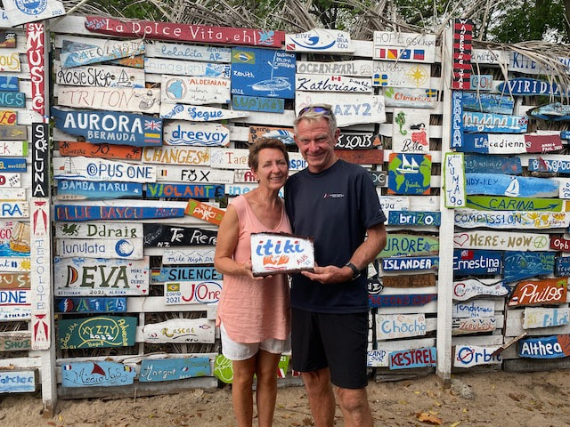
Wall of fame at Paradise Beach Club
Paradise Beach
I have to admit this became a regular haunt for us. From Sandy Island it is a short hop across to anchor off the Paradise Beach Club. Not quite close enough to get the WiFi though. Anyway on Wednesdays they do “sip and paint”, where you paint your boat name/logo on a piece of wood, whilst sipping the cocktail of your choice. Your plaque is later placed on display on the wall of fame. We visited this laid back restaurant several times and the lobster Eggs Benedict is really amazing! Lovely staff and such a chilled vibe.
Hillsboroug
The next bay north of Paradise beach is Hillsborough, the main town of Carriacou. Its not much of an anchorage but it is a good spot to provision as it has more than one supermarket and a few other useful stores and roadside stalls. It was here that I found Patty’s Deli which stock’s FeverTree tonic water at an eye watering A$7 per small bottle! Yes in my desperation I bought some, even though it was more expensive by the mL than the gin we put in it. Here you can also find real cheese and Waitrose canned tomatoes. Only fellow cruisers will understand why this is such a big deal! Sadly the dinghy dock here is really dodgy so Keith drops me off to negotiate the rusting steps which seem to be hanging on by a thread to the wharf. Not so much fun to descend with a well stuffed “nanna-trolley”, but I make it back alive!
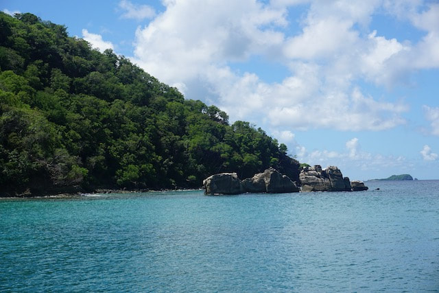
The rocks at Anse La Roche
Anse La Roche
On the NW end of Carriacou is a small bay with a French name which means “rock beach”. It was probably called that because of some rock formations in the south of the bay, which the local kids enjoy launching themselves off. We headed up here on the recommendation of some fellow cruisers that I met at a ladies lunch in Tyrell Bay. There were two other boats here when we arrived, and it’s a small bay so that was a bit of a squeeze, but they both eventually left and we had the place to ourselves. There is a small beach bar here but it closed before sunset, so no music, just peace and quiet. We enjoyed a swimming here and walking along the beach. Check out some more photos here.
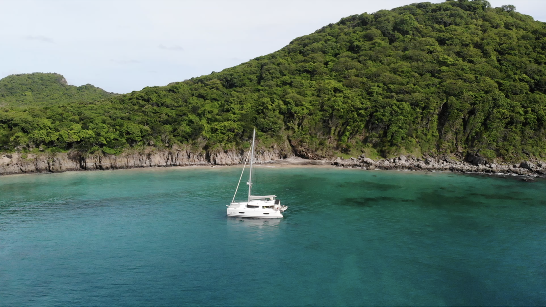
Ronde Island
Between Carriacou and Grenada, right near the Kick-em-Jenny submerged volcano that we avoided on our way south the first time, there is an island with one small anchorage at Ronde Island. We decided to stop here on our second trip south to Grenada and (I think) we are glad we did, although the stay was not without its dramas! It is a beautiful and uninhabited island, with a couple of tiny beaches, rocky shores and very thick vegetation. We put the drone up after lunch and whilst it was doing a circuit it crashed into the trees on the island. The collision avoidance was clearly not working! Keith was ready to write it off but I could see it was still transmitting a picture. It was still alive! We used the “Find my drone” function to find it on the map, which meant tethering Keith’s phone to mine as he did not have a SIM. My battery was almost flat so I had to take the battery pack with me as well. A very tenuous arrangement. Anyway we had a dot on a map and we once we jumped in the RIB we could follow the blue dot and figure out where the drone was relative to us. Keith dropped me off on a very isolated rock as close as possible to the drone, but there was no way to secure the RIB here. It took me a while to get onto the shore as the surf was surging in and I had to wait until it went out again to cross a gap. Then I had to scramble up a steep embankment, to an (almost) track. It was very muddy with loose rocks and cacti and other prickly things, as well as rotting vegetation. It seemed like everything I tried to grab hold of just came away in my hands. When I finally got to the tree-line there were swarms of massive mosquitos waiting for me. The vegetation was incredibly thick and prickly as well. Keith was not far behind and we were struggling to find the drone on the map. Then I found a function that switched on a beeping sound and flashing lights. Keith was able to locate the drone up in the branches of a tree. Fortunately the tree was substantial enough to climb and he was able to get to the drone. Wow that was unexpected! The scramble back down was pretty hairy as well but we made it back to the dinghy which Keith had parked on the beach. As Keith got back on the boat he accidentally kicked the shower head and broke a piece off so it was back into the water with the goggles on to retrieve it. Then the end of his snorkel came off and he had to go and get that too. Exhausting! One broken shower but absolutely no damage to the drone and I have been dubbed Lynd-iana Jones! That wasn’t how we expected to spend our afternoon, but we sure have some interesting drone footage!
Our sister ship Lille Venn
Carriacou Coincidence
So let’s talk about our lovely friends on Lille Venn. Their boat is a Helia, hull 239 (ITIKI is 236). The lovely Ralph and Barbara hail from Basel in Switzerland, they are the proud owners of Lille Venn and we had been in touch in the early days as they had copied a few things on ITIKI, but we never met before and I had forgotten about our contact. We launched in August 2018 prior to French summer holidays and they were 2 months later, so no chance we were in La Rochelle at the same time. We spotted them earlier this year in Deshaies, Guadaloupe and went by to say hi. They were off to Antigua that night so we didn’t get to share a drink but we kept in touch virtually and final met up face to face in Tyrell Bay, Carriacou. Turns out that they had booked to haul out at the same boatyard as us, and one day later! What a coincidence! Sadly our face to face meeting was more of a mask-to-mask meeting as Keith and I had caught Covid in Grenada. Our plans to help each other get ready for haul out were changed to virtual advice over WhatsApp or from the dinghy. We had both booked to stay at the same apartments and with adjoining balconies so we were able to enjoy our evening drinks and some meals together without being in the same airspace. It also turned out we were booked on the same flights from Grenada to Miami. So we really were following each other around! It was meant to be! When we returned to Grenada Ralph was already on Lille Venn and we were able to share our experiences with CopperCoating our boats. Keith and Ralph had worked together to place an order for the materials and Ralph watched on carefully to learn from ITIKI’s experience. All went well on both boats and we enjoyed some time together in Tyrell Bay, The Slipway became our favourite restaurant. It was sad to say goodbye as next time we meet will most likely be in Australia where they are making their way a little more slowly than ITIKI.
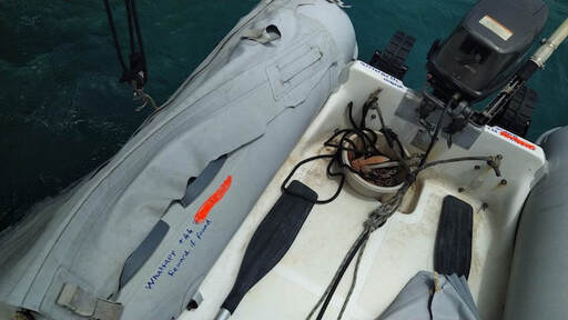
Franken Dinghy
Franken-Dinghy rescue
Before our haul out we were anchored in Tyrell Bay when our friend arrived after a long trip from Martinique. He was temporarily travelling solo, so Keith helped him get anchored and he came over for dinner. Whenever someone comes aboard your boat in their dinghy it is customary to take their line (painter) and help them aboard and then give them their line back so that they tie off their own dinghy, thus leaving the responsibility with them. Here is a great example of why everyone does that… After dinner, probably about 8ish, our friend looks around and notices the absence of his dinghy. Its dark, there is no moon and we don’t know what time it detached itself from the boat. Oh s@#t!! We quickly put our RIB in the water, grab torches and headlamps and off we go in search of Franken-Dinghy (more on that later). Although it is not raining it is amazing how much moisture is in the air. The torchlight reflects on the droplets, reducing visibility. We head out to sea directly from ITIKI in the direction of the current. Not knowing how long the dinghy has been adrift was concerning as once it got past the headlands it could have been taken north or south - who knows?! We get out about a mile or so, scanning the horizon in both directions, turning off torches, drifting for a bit and trying to look at the horizon. We are out well past the abandoned red ferry which marks the end of the anchorage. Keith is just about to suggest we start a grid-search pattern when suddenly our friend spots his dinghy in the torch light a little bit north of us. Oh what a relief! We head straight over to it and are barely alongside it when we are almos touching it our friend leaps through the air onto the dinghy, embracing it like a long lost lover! It’s a very touching re-union. The thought of losing, and having to replace, a dinghy and outboard .. well it just doesn’t bear thinking about. The dinghy is your lifeline between boat and shore when you spend most of your time anchored. Well our adrenalin was pumping when we got back to ITIKI so we all needed a shot of rum to calm our nerves. The dinghy's float rope painter was clearly too slippery to do the job, so Keith found some regular line for him to make a new one. A WhatsApp number has since been added to the dinghy, along with an offer of reward, in case it happens again. And that dear friends, is why you let your guests tie up their own dinghy! It only remains for me to explain why this dinghy has been dubbed “Franken-Dinghy”. Well maybe just take a look at the picture. Making chaps out of an old dinghy certainly does the job of protecting your dinghy from damage, with the added bonus of making it a little less attractive target for theft! Oh and thanks to our successful rescue efforts, as we did claim our reward, which was an item from our friends extensive catalogue of spare parts – a new housing for the strainer for our water-maker, as we had cracked the old one. Brilliant! That is how a runaway dinghy fixed our water-maker.
|
AuthorAfter more than 5 years of (minus time off for Covid) and more than 27,000nm Lynda has finally got the hang of this cruising life Archives
January 2024
Categories |
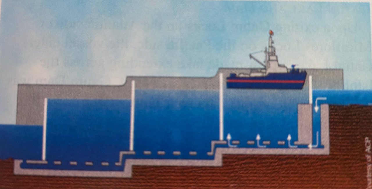
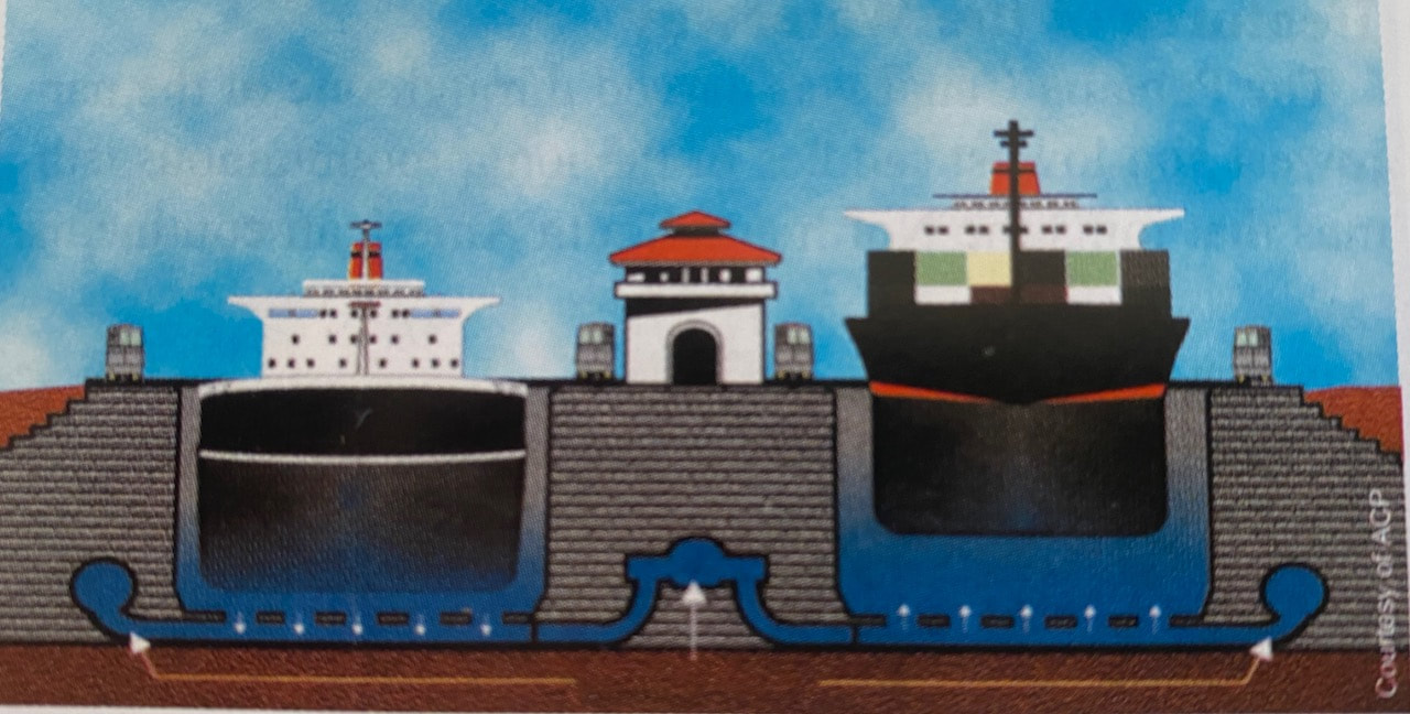
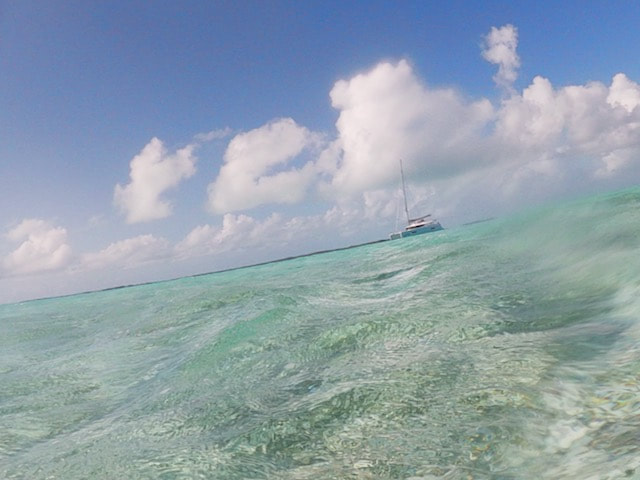
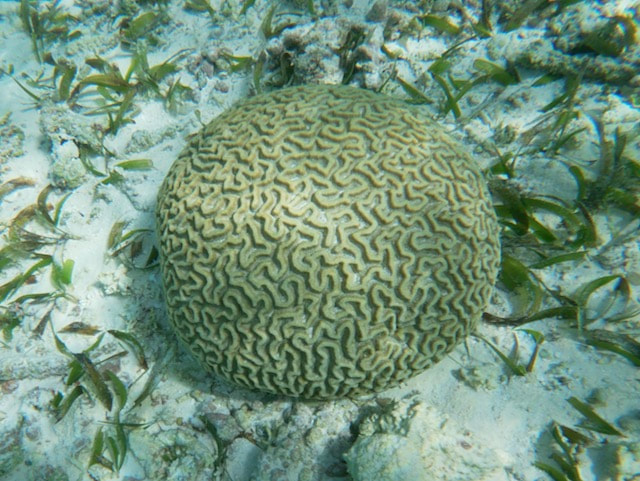
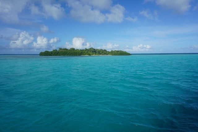
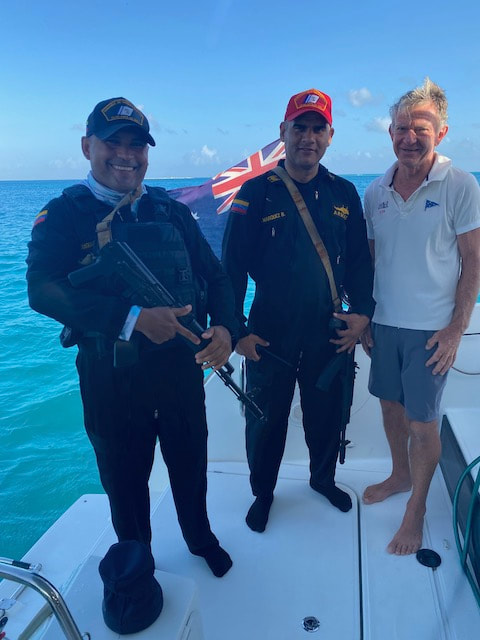
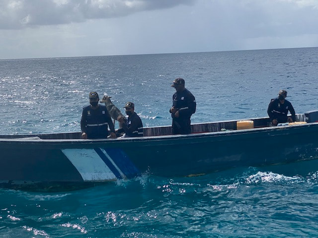
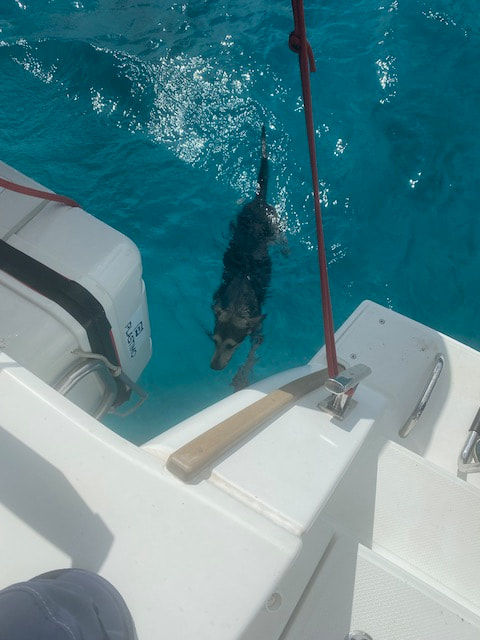
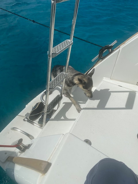
 RSS Feed